
Topografische Karte Provo
Interaktive Karte
Klicken Sie auf die Karte, um die Höhe anzuzeigen.
Über diese Karte
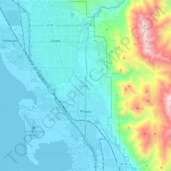
Name: Topografische Karte Provo, Höhe, Relief.
Ort: Provo, Utah County, Utah, United States (40.18580 -111.74096 40.32880 -111.53687)
Durchschnittliche Höhe: 1’728 m
Minimale Höhe: 1’364 m
Maximale Höhe: 3’356 m
Provo lies in the Utah Valley at an elevation of 4,549 feet (1,387 m). According to the United States Census Bureau, the city has an area of 44.2 square miles (114.4 km2), of which 41.7 square miles (107.9 km2) is land and 2.5 square miles (6.5 km2), or 5.66%, is water.