
Topografische Karte Khangabok
Interaktive Karte
Klicken Sie auf die Karte, um die Höhe anzuzeigen.
Über diese Karte
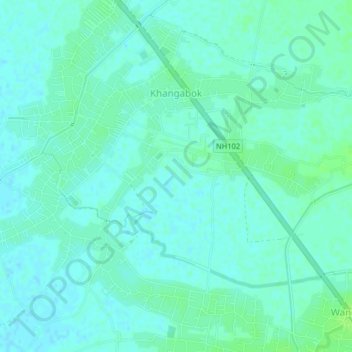
Name: Topografische Karte Khangabok, Höhe, Relief.
Ort: Khangabok, Thoubal, Manipur, India (24.59566 93.98913 24.62921 94.02941)
Durchschnittliche Höhe: 775 m
Minimale Höhe: 771 m
Maximale Höhe: 780 m
The climate of Khangabok is largely influenced by the topography of the hilly region which defines the geography of Manipur. Like other places in Manipur, the village is blessed with a generally amiable climate though the winters can be a little chilly. In winter the mercury often falls near zero degree Celsius. The coldest month is January and July experience maximum temperature. The weather remains bright and sunny without the scorch of the sun during the period from October to March. The village is also drenched in rains from the month of May and continues till the middle of October. The downpour ranges from light drizzles to heavy showers. The normal rainfall enriches the soil and helps in agricultural activities and irrigation.