
Topografische Karte Cody
Interaktive Karte
Klicken Sie auf die Karte, um die Höhe anzuzeigen.
Über diese Karte
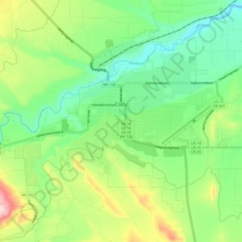
Name: Topografische Karte Cody, Höhe, Relief.
Ort: Cody, Park County, Wyoming, United States (44.48981 -109.12048 44.55131 -109.00576)
Durchschnittliche Höhe: 1’557 m
Minimale Höhe: 1’436 m
Maximale Höhe: 1’798 m
Cody's elevation is approximately 4,997 feet (1,523 m) above sea level. The main part of the city is split across three levels, separated by about 60 feet (18 m).
Andere topografische Karten
Klicken Sie auf eine Karte, um ihre Topografie, ihre Höhe und ihr Relief anzuzeigen.
Yellowstone National Park
United States > Wyoming > Park County
Yellowstone National Park, Park County, Wyoming, United States
Durchschnittliche Höhe: 2’450 m