
Topografische Karte Manhattan
Interaktive Karte
Klicken Sie auf die Karte, um die Höhe anzuzeigen.
Über diese Karte
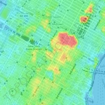
Name: Topografische Karte Manhattan, Höhe, Relief.
Durchschnittliche Höhe: 19 m
Minimale Höhe: -9 m
Maximale Höhe: 63 m
Andere topografische Karten
Klicken Sie auf eine Karte, um ihre Topografie, ihre Höhe und ihr Relief anzuzeigen.
Inwood
United States of America > New York > New York
Inwood, Manhattan Community Board 12, Manhattan, New York County, New York, 10034, United States of America
Durchschnittliche Höhe: 21 m
Manhattan
United States of America > New York > New York
Harlem, Manhattan Community Board 10, Manhattan, New York County, New York, United States of America
Durchschnittliche Höhe: 16 m
Battle Hill
United States of America > New York > New York
Battle Hill, Battle Path, South Slope, Brooklyn, Kings County, New York, 11215, United States of America
Durchschnittliche Höhe: 29 m
WQXR-AM (New York)
United States of America > New York > New York
WQXR-AM (New York), Grand Avenue, Linden Hill, Queens, New York, Queens County, New York, 11373, United States of America
Durchschnittliche Höhe: 13 m
WNYC-AM (New York)
United States of America > New York > New York
WNYC-AM (New York), 8, Greenpoint Avenue, Greenpoint, New York, Brooklyn, Kings County, New York, 11222, United States of America
Durchschnittliche Höhe: 4 m
Seward Park
United States of America > New York > New York
Seward Park, Lower East Side, Manhattan Community Board 3, Manhattan, New York County, New York, United States of America
Durchschnittliche Höhe: 10 m