
Topografische Karte Pathankot
Interaktive Karte
Klicken Sie auf die Karte, um die Höhe anzuzeigen.
Über diese Karte
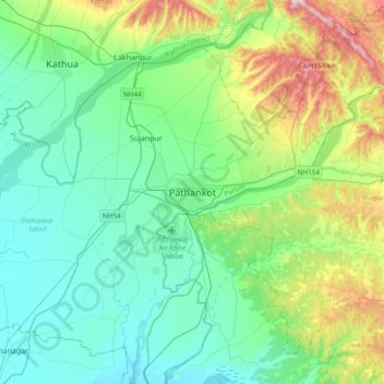
Name: Topografische Karte Pathankot, Höhe, Relief.
Durchschnittliche Höhe: 379 m
Minimale Höhe: 257 m
Maximale Höhe: 782 m
Pathankot has an average elevation of 332 metres (1,089 ft). It is a green town surrounded by the Ravi and Chakki rivers. Shiwalik foothills on the south and east and snow-capped Himalayas in the back drop in north.