
Topografische Karte Devils Lake
Interaktive Karte
Klicken Sie auf die Karte, um die Höhe anzuzeigen.
Über diese Karte
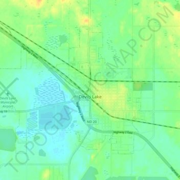
Name: Topografische Karte Devils Lake, Höhe, Relief.
Durchschnittliche Höhe: 443 m
Minimale Höhe: 433 m
Maximale Höhe: 460 m
The first post office was founded November 15, 1882, and was originally named Creelsburg. It was founded by Lieutenant Heber M. Creel, a West Point graduate and topographical engineer stationed at nearby Fort Totten. After resigning from the U.S. Army, he surveyed the land and established the townsite.
Andere topografische Karten
Klicken Sie auf eine Karte, um ihre Topografie, ihre Höhe und ihr Relief anzuzeigen.
Channel A
United States > North Dakota > Ramsey County > Grand Harbor
Channel A, Grand Harbor, Ramsey County, North Dakota, United States
Durchschnittliche Höhe: 445 m
Six Mile Bay
United States > North Dakota > Ramsey County
Six Mile Bay, Ramsey County, North Dakota, United States
Durchschnittliche Höhe: 442 m