
Topografische Karte Crescent City
Interaktive Karte
Klicken Sie auf die Karte, um die Höhe anzuzeigen.
Über diese Karte
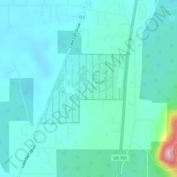
Name: Topografische Karte Crescent City, Höhe, Relief.
Ort: Crescent City, Del Norte County, California, United States (41.84782 -124.16017 41.85846 -124.14190)
Durchschnittliche Höhe: 31 m
Minimale Höhe: 2 m
Maximale Höhe: 203 m
The topography of the sea floor surrounding Crescent City has the effect of focusing tsunamis. According to researchers at Humboldt State University and the University of Southern California, the city experienced tsunami conditions 31 times between the years 1933 and 2008. Although many of these incidents were barely perceptible, eleven events included wave measurements exceeding one meter, four events caused damage, and one event in particular is commonly cited as "the largest and most destructive recorded tsunami to strike the United States Pacific Coast."
Andere topografische Karten
Klicken Sie auf eine Karte, um ihre Topografie, ihre Höhe und ihr Relief anzuzeigen.
Crescent City
United States > California > Del Norte County
Crescent City, Del Norte County, California, 75531, United States
Durchschnittliche Höhe: 6 m
Craigs Creek
United States > California > Del Norte County
Craigs Creek, Del Norte County, California, United States
Durchschnittliche Höhe: 356 m
Crescent City
United States > California > Del Norte County > Crescent City
Crescent City, Del Norte County, California, United States
Durchschnittliche Höhe: 25 m