
Topografische Karte Clyde Hill
Interaktive Karte
Klicken Sie auf die Karte, um die Höhe anzuzeigen.
Über diese Karte
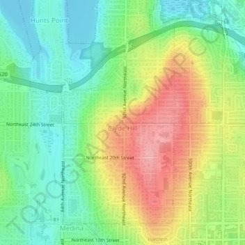
Name: Topografische Karte Clyde Hill, Höhe, Relief.
Durchschnittliche Höhe: 48 m
Minimale Höhe: 0 m
Maximale Höhe: 118 m
The top elevation is close to 375 feet. There are approximately 21 miles of public roadway that make Clyde Hill very centrally located within the Seattle - Bellevue metro area.