
Topografische Karte Ashtabula County
Interaktive Karte
Klicken Sie auf die Karte, um die Höhe anzuzeigen.
Über diese Karte
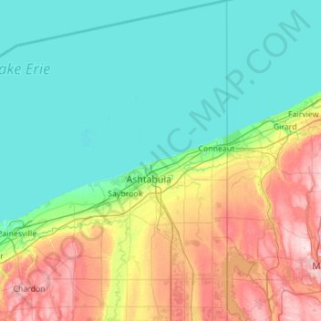
Name: Topografische Karte Ashtabula County, Höhe, Relief.
Ort: Ashtabula County, Ohio, United States (41.49841 -81.00534 42.32324 -80.51930)
Durchschnittliche Höhe: 237 m
Minimale Höhe: 170 m
Maximale Höhe: 450 m
Andere topografische Karten
Klicken Sie auf eine Karte, um ihre Topografie, ihre Höhe und ihr Relief anzuzeigen.
Andover
United States > Ohio > Ashtabula County > Andover
Andover, Ashtabula County, Ohio, 44003, United States
Durchschnittliche Höhe: 332 m
Kingsville
United States > Ohio > Ashtabula County
Kingsville, Ashtabula County, Ohio, 44068, United States
Durchschnittliche Höhe: 226 m