
Topografische Karte Koranga River
Interaktive Karte
Klicken Sie auf die Karte, um die Höhe anzuzeigen.
Über diese Karte
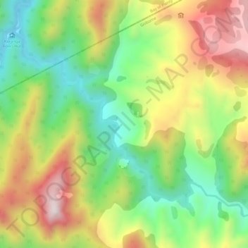
Name: Topografische Karte Koranga River, Höhe, Relief.
Ort: Koranga River, Gisborne, Neuseeland (-38.42750 177.28807 -38.39672 177.34088)
Durchschnittliche Höhe: 582 m
Minimale Höhe: 255 m
Maximale Höhe: 999 m
Andere topografische Karten
Klicken Sie auf eine Karte, um ihre Topografie, ihre Höhe und ihr Relief anzuzeigen.
Hastings
Neuseeland > Hawke's Bay > Hastings District
Hastings, Hastings District, Hawke's Bay, 4122, Neuseeland
Durchschnittliche Höhe: 68 m
1313
Neuseeland > Wellington > Carterton District
1313, Carterton District, Wellington, Neuseeland
Durchschnittliche Höhe: 1’089 m
Waipu
Waipu, Whangarei District, Northland, 0510, Neuseeland
Durchschnittliche Höhe: 13 m
Mackenzie District
Mackenzie District, Canterbury, Neuseeland
Durchschnittliche Höhe: 961 m
Waitākere Ranges
Neuseeland > Auckland > Waitākere Ranges
Waitākere Ranges, Auckland, Neuseeland
Durchschnittliche Höhe: 33 m
Mount Ngāuruhoe
Mount Ngāuruhoe, Ruapehu District, Manawatu-Wanganui, Neuseeland
Durchschnittliche Höhe: 1’726 m
Selwyn District
Selwyn District, Canterbury, Neuseeland
Durchschnittliche Höhe: 679 m
Reefton
Reefton, Buller District, West Coast, 7830, Neuseeland
Durchschnittliche Höhe: 310 m
Aoraki / Mount Cook
Aoraki / Mount Cook, Mackenzie District, Canterbury, Neuseeland
Durchschnittliche Höhe: 2’920 m
Reporoa
Neuseeland > Waikato > Reporoa
Reporoa, Rotorua District, Waikato, Neuseeland
Durchschnittliche Höhe: 304 m
Lake Karapiro
Neuseeland > Waikato > Arapuni
Lake Karapiro, Waikato River Trail, Arapuni, South Waikato District, Waikato, 3494, Neuseeland
Durchschnittliche Höhe: 174 m
Lake Benmore
Lake Benmore, Falston Road, Waitaki District, Canterbury, Neuseeland
Durchschnittliche Höhe: 746 m
Nordinsel
Nordinsel, South Waikato District, Waikato, Neuseeland
Durchschnittliche Höhe: 66 m
Whakatāne District
Whakatāne District, Bay of Plenty, Neuseeland
Durchschnittliche Höhe: 416 m
Godley Glacier
Godley Glacier, Mackenzie District, Canterbury, Neuseeland
Durchschnittliche Höhe: 1’579 m
Südinsel
Südinsel, Ashburton District, Canterbury, Neuseeland
Durchschnittliche Höhe: 201 m
Rotorua District
Rotorua District, Bay of Plenty, Neuseeland
Durchschnittliche Höhe: 404 m
Lake Ōkataina
Neuseeland > Bay of Plenty > Ruato
Lake Ōkataina, Eastern Okataina Walkway, Ruato, Rotorua District, Bay of Plenty, Neuseeland
Durchschnittliche Höhe: 440 m
Mayor Island / Tuhua
Neuseeland > Bay of Plenty > Tauranga
Mayor Island / Tuhua, Tauranga, Bay of Plenty, Neuseeland
Durchschnittliche Höhe: 71 m
Rangitoto Island
Neuseeland > Auckland > Waiheke
Rangitoto Island, Waiheke, Auckland, Neuseeland
Durchschnittliche Höhe: 30 m