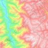
Topografische Karte Trujillo
Klicken Sie auf die Karte, um die Höhe anzuzeigen.
Trujillo
Trujillo is located at an altitude of 34 metres (112 feet) on a coastal strip in the west of the province of Trujillo, in the old valley of Chimor today known as the Moche or Santa Catalina Valley. Its main square is located at 8°6′3″S 79°1′34″W / 8.10083°S 79.02611°W / -8.10083; -79.02611 longitude at an altitude of 31.16 metres (102.23 feet) above sea level and lies 4.40 kilometres (2.73 miles) inland from the Pacific Ocean, in a straight line along Avenido Larco.
Über diese Karte
Name: Topografische Karte Trujillo, Höhe, Relief.
Ort: Trujillo, Province of Trujillo, La Libertad, 13008, Peru (-8.27168 -79.18877 -7.95168 -78.86877)
Durchschnittliche Höhe: 213 m
Minimale Höhe: -1 m
Maximale Höhe: 2’159 m
Andere topografische Karten
Klicken Sie auf eine Karte, um ihre Topografie, ihre Höhe und ihr Relief anzuzeigen.
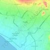
Chan Chan Archaeological Zone
Peru > La Libertad > Huanchaco
The archaeological site at Chan Chan is under constant and severe threat of ruin from weathering. Several archaeologists, conservationists, and an array of institutions are working to survey the architecture existing there. Different methods of survey can be utilized but any methodology must be both quick…
Durchschnittliche Höhe: 25 m