
Topografische Karte Sugar Land
Interaktive Karte
Klicken Sie auf die Karte, um die Höhe anzuzeigen.
Über diese Karte
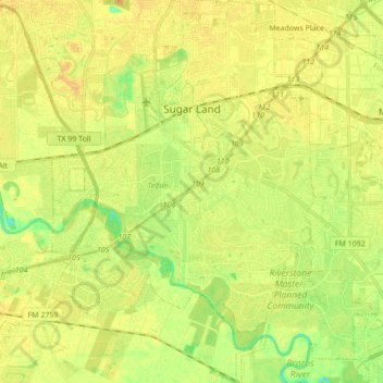
Name: Topografische Karte Sugar Land, Höhe, Relief.
Ort: Sugar Land, Fort Bend County, Texas, United States (29.51252 -95.69811 29.66187 -95.58050)
Durchschnittliche Höhe: 24 m
Minimale Höhe: 8 m
Maximale Höhe: 33 m
Sugar Land is located in northeast Fort Bend County, 20 miles (32 km) southwest of downtown Houston. It is bordered by Houston to the northeast, and by Stafford, Missouri City, and Meadows Place to the east. According to the United States Census Bureau, the city of Sugar Land has a total area of 34.0 square miles (88.1 km2), of which 32.4 square miles (83.9 km2) are land and 1.6 square miles (4.2 km2), or 4.82%, are covered by water. The elevation of most of the city is between 70 and 90 feet (21 and 27 m) above sea level. The elevation of Sugar Land Regional Airport is 82 feet (25 m).
Andere topografische Karten
Klicken Sie auf eine Karte, um ihre Topografie, ihre Höhe und ihr Relief anzuzeigen.
Duke
United States > Texas > Fort Bend County > Arcola
Duke, Arcola, Fort Bend County, Texas, 77545, United States
Durchschnittliche Höhe: 20 m
Missouri City
United States > Texas > Fort Bend County > Missouri City
Missouri City, Fort Bend County, Texas, United States
Durchschnittliche Höhe: 22 m