
Topografische Karte Mount Pinatubo
Interaktive Karte
Klicken Sie auf die Karte, um die Höhe anzuzeigen.
Mount Pinatubo
Even before the 1991 eruption, Mount Pinatubo had little topographic prominence: it was 1,745 m (5,725 ft) above sea level, only about 600 m (2,000 ft) above nearby plains, and only about 200 m (660 ft) higher than surrounding peaks, which largely obscured it from view. It is part of a chain of volcanoes which lie along the western side of the island of Luzon called the Zambales Mountains.
Über diese Karte
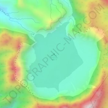
Name: Topografische Karte Mount Pinatubo, Höhe, Relief.
Ort: Mount Pinatubo, Zambales, Central Luzon, Philippines (15.14451 120.34901 15.14461 120.34911)
Durchschnittliche Höhe: 1’047 m
Minimale Höhe: 819 m
Maximale Höhe: 1’424 m
Andere topografische Karten
Klicken Sie auf eine Karte, um ihre Topografie, ihre Höhe und ihr Relief anzuzeigen.