
Topografische Karte Roaring Gap
Interaktive Karte
Klicken Sie auf die Karte, um die Höhe anzuzeigen.
Über diese Karte
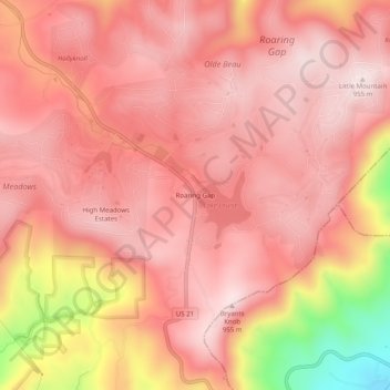
Name: Topografische Karte Roaring Gap, Höhe, Relief.
Durchschnittliche Höhe: 840 m
Minimale Höhe: 492 m
Maximale Höhe: 962 m
Andere topografische Karten
Klicken Sie auf eine Karte, um ihre Topografie, ihre Höhe und ihr Relief anzuzeigen.
Piney Creek
United States > North Carolina > Alleghany County
Piney Creek, Alleghany County, North Carolina, 28663, United States
Durchschnittliche Höhe: 839 m
Laurel Springs
United States > North Carolina > Alleghany County
Laurel Springs, Alleghany County, North Carolina, 28644, United States
Durchschnittliche Höhe: 893 m
Sparta
United States > North Carolina > Alleghany County
Sparta, Alleghany County, North Carolina, 28675, United States
Durchschnittliche Höhe: 893 m