
Topografische Karte Barangay 41
Interaktive Karte
Klicken Sie auf die Karte, um die Höhe anzuzeigen.
Über diese Karte
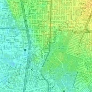
Name: Topografische Karte Barangay 41, Höhe, Relief.
Durchschnittliche Höhe: 13 m
Minimale Höhe: -1 m
Maximale Höhe: 27 m
Andere topografische Karten
Klicken Sie auf eine Karte, um ihre Topografie, ihre Höhe und ihr Relief anzuzeigen.
Balintawak
Balintawak, District 2, Caloocan, Northern Manila District, Metro Manila, Philippines
Durchschnittliche Höhe: 22 m
Bagumbong
Bagumbong, Zone 15, District 1, Caloocan, Northern Manila District, Metro Manila, 1421, Philippines
Durchschnittliche Höhe: 45 m
Camarin
Camarin, District 1, Caloocan, Metro Manila, Philippines
Durchschnittliche Höhe: 68 m