

Topografische Karten Ladakh
Klicken Sie auf eine Karte, um ihre Topografie, ihre Höhe und ihr Relief anzuzeigen.







Daulat Beg Oldi
Daulat Beg Oldi (DBO) lies at the northeastern corner of the Karakoram Range, at the northern edge of Depsang Plains at an elevation of 5,100 metres (16,700 ft). The international border with China is 8 km to the north and the Line of Actual Control with Chinese-controlled Aksai Chin is 9 km to the east. Other…
Durchschnittliche Höhe: 5’085 m
Chang La
Chang La is a high mountain pass in Ladakh at an elevation of 5,391.3024 m (17,688.000 ft) in the Ladakh Range between Leh and the Shyok River valley. The Chang La, on Leh to Pangong Lake road, lies on the Leh-Karu-Sakti-Zingral-Chang La-Durbuk-Tangtse-Pangong Lake motorable road. Karu, which lies on…
Durchschnittliche Höhe: 5’464 m






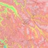
Leh district
Leh is connected to the rest of India by two high-altitude roads both of which are subject to landslides and neither of which are passable in winter when covered by deep snows. The National Highway 1D from Srinagar via Kargil is generally open longer. The Leh-Manali Highway can be troublesome due to very high…
Durchschnittliche Höhe: 4’974 m



Dah
India > Ladakh > Khalsi tehsil
Traveling up the Dah stream, there are several summer habitations, which the inhabitants of Dha occupy for a short time or longer depending on their elevation. While descending, the first areas to appear are Dunder, Cilgiadi, and Cumavcings, which has cultivated fields. The valley stretching along the Dah…
Durchschnittliche Höhe: 3’301 m

Khardung La
India > Ladakh > Leh Tehsil
The elevation of Khardung La is 5,359 m (17,582 ft). Local summit signs and dozens of stores selling shirts in Leh incorrectly claim that its elevation is in the vicinity of 5,602 m (18,379 ft)} and that it is the world's highest motorable pass. But in 2013-2014, Chisumle-Demchok Road via Umling La (19,300…
Durchschnittliche Höhe: 5’235 m







Kargil
India > Ladakh > Kargil tehsil
Kargil has an average elevation of 2,676 m (8,780 ft), and is situated along the banks of the Suru River. The town of Kargil is located 205 km (127 mi) from Srinagar, facing Gilgit-Baltistan across the LoC. Like other areas in the Himalayas, Kargil has a temperate climate. Summers are hot with cool nights,…
Durchschnittliche Höhe: 3’262 m
Dras
Dras (also spelt Drass, ISO transliteration: Drās), also known locally in Shina as Himababs, Hembabs, or Humas, is a town and hill station, and the headquarters of Drass district of the union territory of Ladakh in India. It is on the NH 1 between Zoji La pass and Kargil. A tourist hub for its high-altitude…
Durchschnittliche Höhe: 3’531 m

Umling La Road highest point
Umling La or Umlung La, elevation 19,024 feet (5,799 m), is a mountain pass in the Changthang area of Ladakh, India near the village of Demchok. It is on the ridgeline that divides Koyul Lungpa and the Indus River at an elevation of 19,024 feet (5,799 m). It forms the source for the Umlung stream that drains…
Durchschnittliche Höhe: 5’717 m




Kargil district old
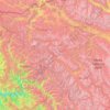
Kargil has an average elevation of 2,676 metres (8,780 feet), and is situated along the banks of the Suru River (Indus). The town of Kargil is located 205 km (127 mi) from Srinagar, facing the Northern Areas across the LOC. Like other areas in the Himalayas, Kargil has a temperate climate. Summers are hot with…
Durchschnittliche Höhe: 4’214 m
Zanskar
Zanskar covers an area of some 7,000 square kilometres (2,700 sq mi), generally at an elevation between 3,600 and 4,000 m (11,800 and 13,100 ft). It consists of the country lying along the two main branches of the Zanskar River. The first, the Doda River, has its source near the Pensi La 4,400 metres (14,400…
Durchschnittliche Höhe: 4’764 m
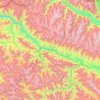
Sham
Aryan Valley Apricot Blossom Festival (locally known as Chuli Mendok) is a 9-days long annual spring celebration held every year usually within first two weeks of April, though dates vary slightly every year as they are tied to the natural blooming cycle of the trees, which is influenced by winter snowfall and…
Durchschnittliche Höhe: 4’490 m
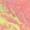
Nubra district
One of the main draws of Nubra is the Khardongla pass, the highest motorable road at 18,380 feet, along with stunning peaks, glaciers, enchanting valleys, and villages. Diskit and Samstanling Monastery, Panamik thermal spring, two-humped camel ride, white-water rafting, hiking, and relaxing in the sand dunes…
Durchschnittliche Höhe: 4’978 m