
Topografische Karte Nevils
Interaktive Karte
Klicken Sie auf die Karte, um die Höhe anzuzeigen.
Über diese Karte
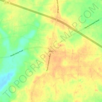
Name: Topografische Karte Nevils, Höhe, Relief.
Ort: Nevils, Bulloch County, Georgia, United States (32.24380 -81.78095 32.28380 -81.74095)
Durchschnittliche Höhe: 51 m
Minimale Höhe: 29 m
Maximale Höhe: 63 m
Andere topografische Karten
Klicken Sie auf eine Karte, um ihre Topografie, ihre Höhe und ihr Relief anzuzeigen.
Brooklet
United States > Georgia > Bulloch County
Brooklet, Bulloch County, Georgia, United States
Durchschnittliche Höhe: 49 m
Stadium Walk
United States > Georgia > Bulloch County > Statesboro > Stadium Walk
Stadium Walk, Statesboro, Bulloch County, Georgia, 30460, United States
Durchschnittliche Höhe: 63 m