
Topografische Karte Rajpura
Interaktive Karte
Klicken Sie auf die Karte, um die Höhe anzuzeigen.
Über diese Karte
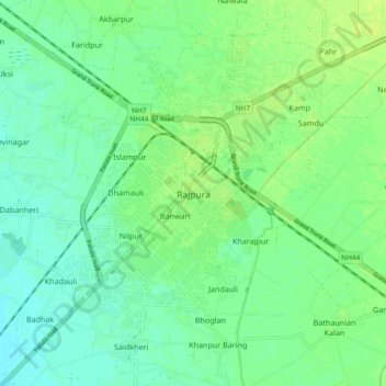
Name: Topografische Karte Rajpura, Höhe, Relief.
Ort: Rajpura, Rajpura Tahsil, Patiala, Punjab, 140401, India (30.43769 76.55377 30.51769 76.63377)
Durchschnittliche Höhe: 270 m
Minimale Höhe: 263 m
Maximale Höhe: 277 m
Rajpura is located at 30°29′N 76°36′E / 30.48°N 76.6°E / 30.48; 76.6. It has an average elevation of 259 metres (849 feet). Rajpura is situated nearly 38 km south west of Chandigarh, the capital city of Punjab. Besides being an important industrial town of Punjab, it also has historical importance.