

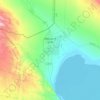
Topografische Karte Aydingkol
Klicken Sie auf die Karte, um die Höhe anzuzeigen.
Über diese Karte

Name: Topografische Karte Aydingkol, Höhe, Relief.
Ort: Aydingkol, Gaochang District, Turpan, Xinjiang, China (42.64094 89.22684 42.67349 89.31662)
Durchschnittliche Höhe: -149 m
Minimale Höhe: -157 m
Maximale Höhe: -99 m
Andere topografische Karten
Klicken Sie auf eine Karte, um ihre Topografie, ihre Höhe und ihr Relief anzuzeigen.

K2
China > Xinjiang > Taxkorgan Tajik Autonomous County > Dafdar
K2 is nicknamed "The King of Mountains" and "The Mountaineers' Mountain", as well as "The Mountain of Mountains", a phrase popularised by Italian climber Reinhold Messner in his book on K2. Although the summit of Everest is at a higher altitude, K2 is a more difficult and dangerous climb. This is in part due…
Durchschnittliche Höhe: 7’482 m


K2
China > Xinjiang > Taxkorgan Tajik Autonomous County > Dafdar
K2 is nicknamed "The King of Mountains" and "The Mountaineers' Mountain", as well as "The Mountain of Mountains", a phrase popularised by Italian climber Reinhold Messner in his book on K2. Although the summit of Everest is at a higher altitude, K2 is a more difficult and dangerous climb. This is in part due…
Durchschnittliche Höhe: 7’482 m
K2
China > Xinjiang > Taxkorgan Tajik Autonomous County > Dafdar
K2 is nicknamed "The King of Mountains" and "The Mountaineers' Mountain", as well as "The Mountain of Mountains", a phrase popularised by Italian climber Reinhold Messner in his book on K2. Although the summit of Everest is at a higher altitude, K2 is a more difficult and dangerous climb. This is in part due…
Durchschnittliche Höhe: 7’482 m
K2
China > Xinjiang > Taxkorgan Tajik Autonomous County > Dafdar
K2 is nicknamed "The King of Mountains" and "The Mountaineers' Mountain", as well as "The Mountain of Mountains", a phrase popularized by Italian climber Reinhold Messner in his book on K2. Although the summit of Everest is at a higher altitude, K2 is a more difficult and dangerous climb. This is in part due…
Durchschnittliche Höhe: 7’482 m

哈尔萨拉村
China > Xinjiang > Hoboksar Mongol Autonomous County > Motge Township
Durchschnittliche Höhe: 1’244 m

K2
China > Xinjiang > Taxkorgan Tajik Autonomous County > Dafdar
K2 is nicknamed "The King of Mountains" and "The Mountaineers' Mountain", as well as "The Mountain of Mountains", a phrase popularised by Italian climber Reinhold Messner in his book on K2. Although the summit of Everest is at a higher altitude, K2 is a more difficult and dangerous climb. This is in part due…
Durchschnittliche Höhe: 7’482 m

齐巴尔玛依沙斛村 شىبار مايساحۋ
China > Xinjiang > Habahe County > Jayilma Township
Durchschnittliche Höhe: 572 m


Changji
China > Xinjiang > Changji City > Changji/Sanji
Surface water includes glaciers, snowmelt, rivers, springs, lakes, reservoirs, and irrigation channels. Glaciers and perennial snow cover mirror altitudes above 3,800 m—present in all counties except Mulei, serving as “natural reservoirs” for runoff. The basin's rivers are short and reliant on mountain…
Durchschnittliche Höhe: 1’309 m


Broad Peak
China > Xinjiang > Taxkorgan Tajik Autonomous County > Dafdar
Broad Peak is one of the eight-thousanders, and is located in the Karakoram range spanning Gilgit-Baltistan, Pakistan and Xinjiang, China. It is the 12th highest mountain in the world at 8,051 metres (26,414 ft) elevation above sea level. The first ascent of this mountain was in June 1957, accomplished by…
Durchschnittliche Höhe: 7’117 m

Ürümqi
The largest city in western China, Ürümqi has earned a place in the Guinness Book of Records as the most remote city from any sea in the world. It is about 2,500 kilometres (1,600 mi) from the nearest coastline as Ürümqi is the closest major city to the Eurasian pole of inaccessibility, although Karamay…
Durchschnittliche Höhe: 1’294 m


Gasherbrum II
China > Xinjiang > Cenling County
Gasherbrum II is located on the border of Gilgit–Baltistan, Pakistan, and Xinjiang, China. It is part of the Karakoram mountain range in the Himalayas, and located at the top of the Baltoro Glacier. With an elevation of 8,034 metres (26,358 ft) it is the third-highest member of the Gasherbrum group, behind…
Durchschnittliche Höhe: 7’098 m

Barköl Kazakh Autonomous County
Barkol Kazakh Autonomous County spans a total area of 38,400 square kilometres (14,800 mi2), including 25,500 square kilometres (9,800 mi2) of mountains and the Gobi Desert, accounting for 66% of the total area of the autonomous county. The terrain is high in the southeast and low in the northwest, with an…
Durchschnittliche Höhe: 1’436 m


Muztagh Ata
China > Xinjiang > Aqto County > Bulungkol Township
Muztagh Ata (meaning 'Ice Mountain Father' in English), formerly known as Mount Tagharma and Wi-tagh, is the second highest of the mountains which form the northern edge of the Tibetan Plateau, with an elevation of 7,546 m (24,757 ft). It is sometimes regarded as being part of the Kunlun Mountains, although…
Durchschnittliche Höhe: 6’786 m
Kongur Tagh
China > Xinjiang > Aqto County > Bulungkol Township
Kongur Tagh (Kyrgyz: Коңур Тоо; Uyghur: قوڭۇر تاغ, Коңур Тағ, meaning "Brown Mountain"; Mongolian: Хонгор Таг, (Хонгор/Kongur/Kongur is Mongolian word for the color Mongolians use for Buckskin colored horse) Hongor Tag; simplified Chinese: 公格尔峰; traditional…
Durchschnittliche Höhe: 6’904 m
Yarkand
China > Xinjiang > Yarkant County
Yarkant County, also Shache County, also transliterated from Uyghur as Yakan County, is a county in the Xinjiang Uyghur Autonomous Region, China, located on the southern rim of the Taklamakan Desert in the Tarim Basin. It is one of 11 counties administered under Kashgar Prefecture. The county, usually referred…
Durchschnittliche Höhe: 1’227 m


Barköl Kazakh Autonomous County
Barkol Kazakh Autonomous County spans a total area of 38,400 square kilometres (14,800 mi2), including 25,500 square kilometres (9,800 mi2) of mountains and the Gobi Desert, accounting for 66% of the total area of the autonomous county. The terrain is high in the southeast and low in the northwest, with an…
Durchschnittliche Höhe: 1’436 m

Ürümqi
The largest city in western China, Ürümqi has earned a place in the Guinness Book of Records as the most remote city from any sea in the world. It is about 2,500 kilometres (1,600 mi) from the nearest coastline as Ürümqi is the closest major city to the Eurasian pole of inaccessibility, although Karamay…
Durchschnittliche Höhe: 1’294 m


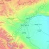
Turpan Depression
China > Xinjiang > Gaochang District
The Turpan Basin formed in a shear zone during the Late Permian due to motion between the East European and the Angaran craton. It was subsequently deformed by the collision of the Indian and Eurasian plates in the Cenozoic. In the latter deformation, a thrust fault belt running from east to west, the Flaming…
Durchschnittliche Höhe: -153 m
Tashkorgan Town
China > Xinjiang > Taxkorgan Tajik Autonomous County
Stein argued that, judging from the topography and remains found around Tashkurgan, the fort and associated settlements had clearly been central to the broader Sarikol area, controlling routes from the Oxus to the oases of southern Turkestan.
Durchschnittliche Höhe: 3’109 m


Yarkant County
Yarkant County, also Shache County, also transliterated from Uyghur as Yakan County, is a county in the Xinjiang, China, located on the southern rim of the Taklamakan Desert in the Tarim Basin. It is one of 11 counties administered under Kashgar Prefecture. The county, usually referred to as Yarkand in…
Durchschnittliche Höhe: 1’709 m








Ürümqi
The largest city in western China, Ürümqi has earned a place in the Guinness Book of Records as the most remote city from any sea in the world. It is about 2,500 kilometres (1,600 mi) from the nearest coastline as Ürümqi is the closest major city to the Eurasian pole of inaccessibility, although Karamay…
Durchschnittliche Höhe: 1’294 m

Ulugqat County
There are 11 local ethnic groups in the county, such as Kyrgyz, Han, Uyghur, Hui, Uzbek, Tajik, etc. and the Kyrgyz ethnic group accounts for about 80% of the total population of the county. Its total land area of the county is 19,118 square kilometers with an average elevation of 2,890 meters and its county…
Durchschnittliche Höhe: 3’049 m


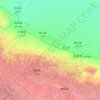


Toyun Township
China > Xinjiang > Ulugqat County
The seat of Tuoyun Township is at 2,780 meters above sea level. The average elevation of the township is above 3,300 meters. The highest altitude is 5,031 meters. The altitude of each pasture is 3,000-4,500 meters. More than 98% are Gobi desert and saline-alkali land, and the climate is extremely bad. The…
Durchschnittliche Höhe: 3’537 m

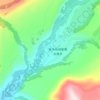
Kom
China > Xinjiang > Burqin County > Kom-Kanas Mongolian Ethnic Township
Durchschnittliche Höhe: 1’197 m
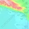
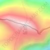
Jengish Chokusu
China > Xinjiang > Onsu County
Jengish Chokusu or Victory Peak is the highest mountain in the Tian Shan mountain system in Central Asia at 7,439 metres (24,406 ft). It lies on the China–Kyrgyzstan border between the Ak-Suu District in the Issyk-Kul Region of far Eastern Kyrgyzstan and Wensu County, Xinjiang, China. It is part of the…
Durchschnittliche Höhe: 6’681 m


