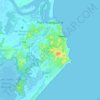
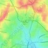
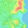
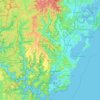
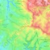
Topografische Karte Sydney
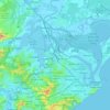
Klicken Sie auf die Karte, um die Höhe anzuzeigen.
Sydney
Phillip had been given no instructions for urban development, but in July 1788 submitted a plan for the new town at Sydney Cove. It included a wide central avenue, a permanent Government House, law courts, hospital and other public buildings, but no provision for warehouses, shops, or other commercial buildings. Phillip promptly ignored his own plan, and unplanned development became a feature of Sydney's topography.
Über diese Karte

Name: Topografische Karte Sydney, Höhe, Relief.
Durchschnittliche Höhe: 32 m
Minimale Höhe: -6 m
Maximale Höhe: 212 m
Andere topografische Karten
Klicken Sie auf eine Karte, um ihre Topografie, ihre Höhe und ihr Relief anzuzeigen.
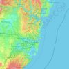
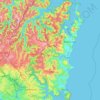
Sydney
Sydney's topography is characterized by a diverse landscape that seamlessly blends coastal features with inland plateaus. The city is divided into two primary regions: the relatively flat Cumberland Plain to the south and west of Sydney Harbour, and the elevated Hornsby Plateau to the north. The Cumberland…
Durchschnittliche Höhe: 56 m










Barrington Tops National Park
The climate varies from temperate on the lower altitudes to subalpine at highest elevations. A record low of −17 °C (1 °F) has been registered at 1,500 m (4,900 ft) above mean sea level. Rainfalls fluctuate between 750 millimetres (30 in) in the northwest to more than 2,000 mm (79 in) in the southeast.
Durchschnittliche Höhe: 736 m




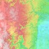
Blue Mountains
A sandstone plateau dominated by a landscape of endless eucalyptus forests, the Blue Mountains are located at the top of a 470-million-year-old quartzite. In the Permian period, a shallow sea covered the region, when rivers brought shales, siltstones and mudstones. Then during the Mesozoic period, rivers…
Durchschnittliche Höhe: 566 m
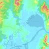




Mount Victoria
Mount Victoria (postcode: 2786) is a small township in the Blue Mountains of New South Wales, Australia. Mount Victoria is geographically the western most village and suburb of Greater Sydney on the great western highway in the City of Blue Mountains, located about 120 kilometres (75 mi) west-northwest by road…
Durchschnittliche Höhe: 901 m
Byron Bay
Byron Bay, located in northeastern New South Wales, Australia, is characterized by diverse topography shaped by its geological history. The town is part of the erosion caldera of the ancient Tweed Volcano, which erupted approximately 23 million years ago, resulting in the rich volcanic soils that define the…
Durchschnittliche Höhe: 7 m






Glenrock State Conservation Area
Australia > New South Wales > Newcastle-Maitland
Durchschnittliche Höhe: 42 m




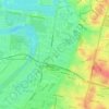
Penrith
Australia > New South Wales > Sydney > Penrith
Penrith is a city in New South Wales, Australia, located in Greater Western Sydney, 55 kilometres (31 mi) west of the Sydney central business district on the banks of the Nepean River, on the outskirts of the Cumberland Plain. Its elevation is 32 metres (105 ft).
Durchschnittliche Höhe: 34 m