
Topografische Karte Alderley Edge
Interaktive Karte
Klicken Sie auf die Karte, um die Höhe anzuzeigen.
Über diese Karte
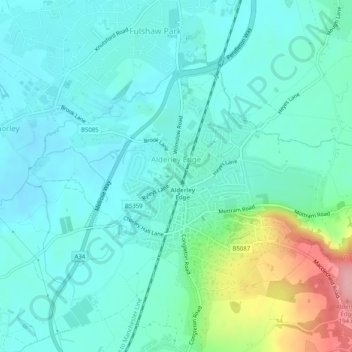
Name: Topografische Karte Alderley Edge, Höhe, Relief.
Durchschnittliche Höhe: 91 m
Minimale Höhe: 63 m
Maximale Höhe: 194 m
Alderley Edge is 6 miles (10 km) northwest of Macclesfield and 12 miles (19 km) south of Manchester, at the base of a steep and thickly wooded sandstone escarpment, Alderley Edge, which is the area's chief topographical feature and overlooks the Cheshire Plain.