
Topografische Karte Warrior
Interaktive Karte
Klicken Sie auf die Karte, um die Höhe anzuzeigen.
Über diese Karte
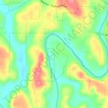
Name: Topografische Karte Warrior, Höhe, Relief.
Ort: Warrior, Jefferson County, Alabama, United States (33.81987 -86.77209 33.83032 -86.76965)
Durchschnittliche Höhe: 130 m
Minimale Höhe: 91 m
Maximale Höhe: 181 m
Warrior is in the Central time zone. The elevation at the center of town is 564 feet (172 m), though it ranges from over 620 feet (190 m) north of the center to less than 300 feet (91 m) along the Locust Fork of the Black Warrior River, which forms the southern boundary of the city.