
Topografische Karte Xiangxi
Klicken Sie auf die Karte, um die Höhe anzuzeigen.
Xiangxi
Xiangxi Tujia and Miao Autonomous Prefecture is located in a low-latitude zone and has a humid subtropical monsoon climate. It is characterized by the influence of the topography of the Wuling Mountains: the winter is relatively cold, the summer temperature is high and humid, the spring and summer are wet and rainy, the weather is changeable, the autumn weather turns cooler, the temperature drops, the monsoon is obvious, and the four seasons are distinct. The average temperature for many years is between 16.0~17.0 °C, the average temperature in January is between 4.5~5.2 °C, and the extreme minimum temperature is -15.5 °C (January 30, 1977); the average temperature in July is between 21.9~22.8 °C, and the extreme maximum temperature is 40.6 °C (1959 8 29th of the month). The average annual growth period is 340 days, the annual frost-free period is 282 days, the longest is 340 days, and the shortest is 235 days. The annual sunshine hours are 1151.6~1390.5 hours, and the total annual radiation is 376.6~412.2. Kilojoules/square centimeter. The average annual precipitation is 1284.2~1416.9 mm, and the average annual rainfall days is 171.80 days. The maximum daily precipitation over the years is 344.1 mm, and the minimum daily precipitation over the years is 32.4 mm. Rainfall is concentrated from April to September every year, accounting for 70.8~77.3% of the annual precipitation.
Über diese Karte
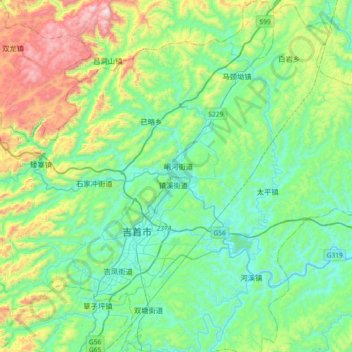
Name: Topografische Karte Xiangxi, Höhe, Relief.
Durchschnittliche Höhe: 542 m
Minimale Höhe: 97 m
Maximale Höhe: 2’457 m