
Topografische Karte Talbot Bay
Klicken Sie auf die Karte, um die Höhe anzuzeigen.
Über diese Karte
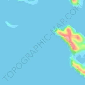
Name: Topografische Karte Talbot Bay, Höhe, Relief.
Durchschnittliche Höhe: 7 m
Minimale Höhe: 0 m
Maximale Höhe: 127 m
Andere topografische Karten
Klicken Sie auf eine Karte, um ihre Topografie, ihre Höhe und ihr Relief anzuzeigen.
Exmouth
In 2009, an emergency landing of the flight Qantas 72 was made at the nearby Learmonth Airport / RAAF Base Learmonth. The A330 had an incident involving the ADIRU which confused AoA (Angle of Attack) data with altitude data, making the plane think it was in a 16° pitch up when it was flying level. So the…
Durchschnittliche Höhe: 27 m
Ellenbrook
The suburb sits in the south-east corner of the Gnangara Mound, close to the Darling Scarp. Topographically, the majority of Ellenbrook's area sits between 40-50 metres above sea level on the mound, with parts of Coolamon and Malvern Springs situated on hills that reach peaks of 65 metres. The northern village…
Durchschnittliche Höhe: 49 m
Henley Brook
Henley Brook is situated on the flood plains of the Swan River, with regularly occurring seasonal floods. Two ephemeral streams from the river - Henley Brook and St. Leonard's Creek - traverse the suburb. Henley Brook is in the north-east near Brockman Street, while St Leonards Creek traverses the centre of…
Durchschnittliche Höhe: 28 m