
Topografische Karte Roan Mountain
Interaktive Karte
Klicken Sie auf die Karte, um die Höhe anzuzeigen.
Über diese Karte
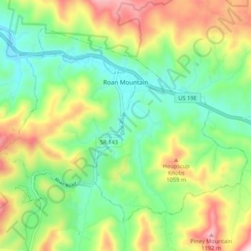
Name: Topografische Karte Roan Mountain, Höhe, Relief.
Durchschnittliche Höhe: 926 m
Minimale Höhe: 760 m
Maximale Höhe: 1’210 m
Roan Mountain is located in northeast Tennessee at 36°11′39″N 82°4′6″W / 36.19417°N 82.06833°W / 36.19417; -82.06833 (36.194219, -82.068417). According to the United States Census Bureau, the CDP has a total area of 6.6 square miles (17.2 km2), all land. The elevation of Roan Mountain near the center of the CDP is 2,550 feet (780 m).