Topografische Karte El Mazo
Interaktive Karte
Klicken Sie auf die Karte, um die Höhe anzuzeigen.
Über diese Karte
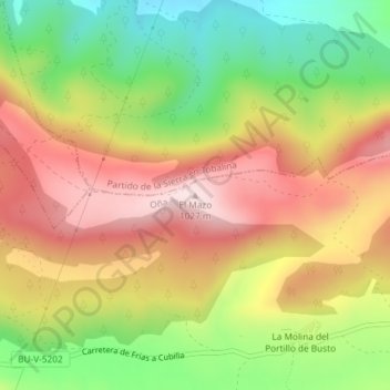
Name: Topografische Karte El Mazo, Höhe, Relief.
Ort: El Mazo, Oña, Burgos, Castilla y León, España (42.71415 -3.24237 42.71425 -3.24227)
Durchschnittliche Höhe: 839 m
Minimale Höhe: 650 m
Maximale Höhe: 1’017 m
Andere topografische Karten
Klicken Sie auf eine Karte, um ihre Topografie, ihre Höhe und ihr Relief anzuzeigen.
Cornudilla
España > Castilla y León > Oña
Cornudilla, Oña, Burgos, Castilla y León, 09210, España
Durchschnittliche Höhe: 647 m
San Frutos
España > Castilla y León > Oña
San Frutos, Oña, Burgos, Castilla y León, 09530, España
Durchschnittliche Höhe: 654 m
Ventanas
España > Castilla y León > Oña
Ventanas, Oña, Burgos, Castilla y León, España
Durchschnittliche Höhe: 940 m
Mazo
España > Castilla y León > Oña
Mazo, Oña, Burgos, Castilla y León, España
Durchschnittliche Höhe: 839 m
Valdefrades
España > Castilla y León > Oña
Valdefrades, Oña, Burgos, Castilla y León, 09530, España
Durchschnittliche Höhe: 684 m