

Topografische Karte Prato
Klicken Sie auf die Karte, um die Höhe anzuzeigen.
Prato
Prato (/ˈprɑːtoʊ/ PRAH-toh; Italian: [ˈpraːto] ) is a city and municipality (comune) in Tuscany, Italy, and is the capital of the province of Prato. The city lies in the northeast of Tuscany, at an elevation of 65 metres (213 ft), at the foot of Monte Retaia (the last peak in the Calvana chain). With 198,326 inhabitants as of 2025, Prato is Tuscany's second largest city after Florence, and the third largest in Central Italy.
Über diese Karte
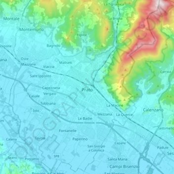
Name: Topografische Karte Prato, Höhe, Relief.
Ort: Prato, Tuscany, Italy (43.81576 11.01317 43.94948 11.16961)
Durchschnittliche Höhe: 148 m
Minimale Höhe: 31 m
Maximale Höhe: 916 m
Andere topografische Karten
Klicken Sie auf eine Karte, um ihre Topografie, ihre Höhe und ihr Relief anzuzeigen.
