
Spenden
Rüste dich für dein nächstes Abenteuer:
Als Amazon-Partner verdient diese Seite an qualifizierten Käufen, ohne dass Ihnen zusätzliche Kosten entstehen.
Topografische Karte Hickory Ridge
Klicken Sie auf die Karte, um die Höhe anzuzeigen.
Spenden
Rüste dich für dein nächstes Abenteuer:
Als Amazon-Partner verdient diese Seite an qualifizierten Käufen, ohne dass Ihnen zusätzliche Kosten entstehen.
Hickory Ridge
Hickory Ridge is within the Mississippi embayment of the Mississippi Alluvial Plain, a flat fertile floodplain of the Mississippi River. In Arkansas, an economic and cultural region roughly following this geography is known as the Arkansas Delta (or "the Delta"). Roughly the western third of Cross County is within the Western Lowlands Pleistocene Valley Train subregion of the Delta. This region is characterized as flat windblown deposits of silty, sandy soils, and loess with a high groundwater table. Post oak and loblolly pine are native in the higher elevations, with overcup oak, water hickory, willow oak, and pin oak and pondberry native in wetlands. Today, row agriculture is extensive (mostly soybeans and cotton), with commercial aquaculture (crawfish, baitfish, and catfish farms) also common.
Spenden
Rüste dich für dein nächstes Abenteuer:
Als Amazon-Partner verdient diese Seite an qualifizierten Käufen, ohne dass Ihnen zusätzliche Kosten entstehen.
Über diese Karte
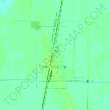
Name: Topografische Karte Hickory Ridge, Höhe, Relief.
Ort: Hickory Ridge, Cross County, Arkansas, United States (35.39527 -91.00010 35.41172 -90.98437)
Durchschnittliche Höhe: 70 m
Minimale Höhe: 64 m
Maximale Höhe: 74 m
Spenden
Rüste dich für dein nächstes Abenteuer:
Als Amazon-Partner verdient diese Seite an qualifizierten Käufen, ohne dass Ihnen zusätzliche Kosten entstehen.