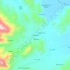
Topografische Karte Cabanillas
Klicken Sie auf die Karte, um die Höhe anzuzeigen.
Über diese Karte

Name: Topografische Karte Cabanillas, Höhe, Relief.
Ort: Cabanillas, Province of San Román, Puno, Peru (-16.03419 -70.89629 -15.61981 -70.32601)
Durchschnittliche Höhe: 4’395 m
Minimale Höhe: 3’771 m
Maximale Höhe: 5’281 m
Andere topografische Karten
Klicken Sie auf eine Karte, um ihre Topografie, ihre Höhe und ihr Relief anzuzeigen.

Puno
As Puno is located at such a high elevation, it experiences more extreme weather conditions than would be expected for its tropical latitude. The average annual temperature is about 8.4 °C (47.1 °F), and the weather never gets overly warm. During the winter from June to August, night-time temperatures…
Durchschnittliche Höhe: 3’960 m

Juliaca
Juliaca is a large trade center for goods and services, and is considered the financial capital of the Puno region. Trade is its principal economic activity, comprising 26.5% of the Labor force. In 2008, Juliaca had 15,439 commercial establishments, which amounts to 41% of trade done in the Puno region. It is…
Durchschnittliche Höhe: 3’861 m

La Rinconada
High in the Andes, La Rinconada has an alpine tundra climate (ET, according to the Köppen climate classification), with no month having mean temperatures even close to the 10 °C (50 °F) threshold that would permit tree growth and a subtropical highland classification for the city. Far above the tree line,…
Durchschnittliche Höhe: 4’923 m

La Rinconada
The town has gained notoriety for its extreme living conditions that include its high rates of altitude sickness, pollution, poverty, murder, and sex trafficking, and as a result has sometimes been referred to in Spanish as la ciudad sin ley del Perú, which means "the lawless city of Peru".
Durchschnittliche Höhe: 4’923 m

La Rinconada
High in the Andes, La Rinconada has an alpine tundra climate (ET, according to the Köppen climate classification), with no month having mean temperatures even close to the 10 °C (50 °F) threshold that would permit tree growth and a subtropical highland classification for the city. Far above the tree line,…
Durchschnittliche Höhe: 4’923 m
Juliaca
Juliaca is a large trade center for goods and services, and is considered the financial capital of the Puno region. Trade is its principal economic activity, comprising 26.5% of the Labor force. In 2008, Juliaca had 15,439 commercial establishments, which amounts to 41% of trade done in the Puno region. It is…
Durchschnittliche Höhe: 3’861 m




La Rinconada
The town has gained notoriety for its extreme living conditions that include its high rates of altitude sickness, pollution, poverty, murder, and sex trafficking, and as a result has sometimes been referred to in Spanish as la ciudad sin ley del Perú, which means "the lawless city of Peru".
Durchschnittliche Höhe: 4’923 m




La Rinconada
High in the Andes, La Rinconada has an alpine tundra climate (ET, according to the Köppen climate classification), with no month having mean temperatures even close to the 10 °C (50 °F) threshold that would permit tree growth and a subtropical highland classification for the city. Far above the tree line,…
Durchschnittliche Höhe: 4’923 m