
Topografische Karte Westwood Estates
Interaktive Karte
Klicken Sie auf die Karte, um die Höhe anzuzeigen.
Über diese Karte
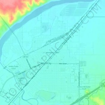
Name: Topografische Karte Westwood Estates, Höhe, Relief.
Durchschnittliche Höhe: 724 m
Minimale Höhe: 709 m
Maximale Höhe: 802 m
Andere topografische Karten
Klicken Sie auf eine Karte, um ihre Topografie, ihre Höhe und ihr Relief anzuzeigen.
Carbon Hill Trailer Court
United States > Montana > Custer County > Miles City
Carbon Hill Trailer Court, Miles City, Custer County, Montana, 59301, United States
Durchschnittliche Höhe: 732 m
Cook Lake
United States > Montana > Custer County > Miles City > Smiths Trailer Court
Cook Lake, Smiths Trailer Court, Miles City, Custer County, Montana, United States
Durchschnittliche Höhe: 721 m