
Topografische Karte Kadifekale
Interaktive Karte
Klicken Sie auf die Karte, um die Höhe anzuzeigen.
Über diese Karte
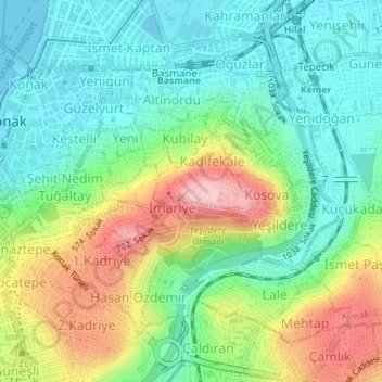
Name: Topografische Karte Kadifekale, Höhe, Relief.
Durchschnittliche Höhe: 65 m
Minimale Höhe: 0 m
Maximale Höhe: 186 m
Kadifekale (literally "the velvet castle" in Turkish) is a hilltop castle in İzmir, Turkey. The castle is located on the Mount Pagos (Greek: Πάγος, Pagus under the Roman Empire) which has an elevation of 186 metres. It was built in the 3rd century BC. The castle is located at a distance of about 2 km from the shoreline and commands a general view of a large part of the city of İzmir, as well as of the Gulf of İzmir.
Andere topografische Karten
Klicken Sie auf eine Karte, um ihre Topografie, ihre Höhe und ihr Relief anzuzeigen.
Millet Mahallesi
Millet Mahallesi, Izmir, Konak, Aegean Region, Turkey
Durchschnittliche Höhe: 132 m