
Topografische Karte Brookings County
Interaktive Karte
Klicken Sie auf die Karte, um die Höhe anzuzeigen.
Über diese Karte
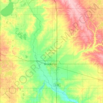
Name: Topografische Karte Brookings County, Höhe, Relief.
Ort: Brookings County, South Dakota, United States (44.19593 -97.12974 44.54378 -96.45182)
Durchschnittliche Höhe: 525 m
Minimale Höhe: 472 m
Maximale Höhe: 617 m
Brookings County is on the east side of South Dakota. Its east boundary line abuts the west boundary line of the state of Minnesota. The Big Sioux River flows south-southeastward through the east central part of the county; its point of entry into Moody County marks Brookings County's lowest elevation: 1,568' (478m) ASL.
Andere topografische Karten
Klicken Sie auf eine Karte, um ihre Topografie, ihre Höhe und ihr Relief anzuzeigen.
Brookings
United States > South Dakota > Brookings County
Brookings, Brookings County, South Dakota, United States
Durchschnittliche Höhe: 495 m