
Topografische Karte Blackville
Interaktive Karte
Klicken Sie auf die Karte, um die Höhe anzuzeigen.
Über diese Karte
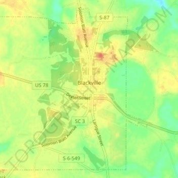
Name: Topografische Karte Blackville, Höhe, Relief.
Durchschnittliche Höhe: 85 m
Minimale Höhe: 63 m
Maximale Höhe: 105 m
Andere topografische Karten
Klicken Sie auf eine Karte, um ihre Topografie, ihre Höhe und ihr Relief anzuzeigen.
Williston
United States > South Carolina > Barnwell County
Williston, Barnwell County, South Carolina, 29853, United States
Durchschnittliche Höhe: 101 m
Barnwell
United States > South Carolina > Barnwell County > Barnwell
Barnwell, Barnwell County, South Carolina, 29812, United States
Durchschnittliche Höhe: 65 m
Hilda
United States > South Carolina > Barnwell County > Hilda
Hilda, Barnwell County, South Carolina, 29813, United States
Durchschnittliche Höhe: 78 m