Geolokalisieren

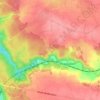
Topografische Karte Eure

Klicken Sie auf die Karte, um die Höhe anzuzeigen.

Eure

D'une altitude moyenne de 150 mètres, l'Eure est un département constitué de plateaux séparés par des vallées plus ou moins profondes. Celles-ci délimitent les différentes régions naturelles qui sont au nombre de 13 : le pays de Lyons, le Vexin normand, le Vexin bossu, la vallée de la Seine, le plateau de Madrie, la campagne de Saint-André, le plateau du Neubourg, le pays d'Ouche (partagé avec l'Orne), le Roumois, le Lieuvin, le Marais-Vernier, le pays d'Auge (partagé avec le Calvados et l'Orne) et un petit secteur du Perche, qui se prolonge dans les départements d'Eure-et-Loir et de l'Orne.

Wikipedia (CC-BY-SA 3.0)

Über diese Karte

Name: Topografische Karte Eure, Höhe, Relief.

Ort: Eure, Normandie, France métropolitaine, France (48.66642 0.29616 49.48482 1.80286)

Durchschnittliche Höhe: 141 m

Minimale Höhe: -3 m

Maximale Höhe: 331 m

Andere topografische Karten

Klicken Sie auf eine Karte, um ihre Topografie, ihre Höhe und ihr Relief anzuzeigen.

Collines de Normandie

France > Normandie > Orne

Durchschnittliche Höhe: 196 m

La Palaserie

France > Normandie > Orne > Pouvrai

Durchschnittliche Höhe: 131 m

Sérigny

France > Normandie > Orne

Durchschnittliche Höhe: 196 m

Secqueville

France > Normandie > Calvados > Le Castelet > Garcelles-Secqueville

Durchschnittliche Höhe: 65 m
Le Launay

France > Normandie > Calvados > Aurseulles

Durchschnittliche Höhe: 126 m

La Sentelle

France > Normandie > Eure > Mesnil-en-Ouche > La Roussière

Durchschnittliche Höhe: 192 m

Le Poiré

France > Normandie > Manche > Morville

Durchschnittliche Höhe: 30 m

Malvoue

France > Normandie > Orne > Vimoutiers

Durchschnittliche Höhe: 178 m

Le Val

France > Normandie > Calvados > Saint-Pierre-en-Auge

Durchschnittliche Höhe: 81 m

La Piventière

France > Normandie > Calvados > Saint-Rémy

Durchschnittliche Höhe: 112 m

Le Vieux Moulin

France > Normandie > Calvados > Le Molay-Littry

Durchschnittliche Höhe: 62 m

Saint-Germain-sur-Ay-Plage

France > Normandie > Manche

Durchschnittliche Höhe: 3 m

Lac du Gast

France > Normandie > Calvados > Noues de Sienne

Durchschnittliche Höhe: 280 m

La Haye

France > Normandie > Calvados > Noues de Sienne

Durchschnittliche Höhe: 226 m

Le Haut Bisson

France > Normandie > Orne > Landisacq

Durchschnittliche Höhe: 233 m

Bures-sur-Dives

France > Normandie > Calvados

Durchschnittliche Höhe: 17 m

Le Pont de Brie

France > Normandie > Calvados > Montillières-sur-Orne

Durchschnittliche Höhe: 97 m

Les Drouets

France > Normandie > Eure > Routot

Durchschnittliche Höhe: 131 m

La Tessonnière

France > Normandie > Calvados > Vire Normandie

Durchschnittliche Höhe: 198 m

La Butte

France > Normandie > Calvados > Vire Normandie

Durchschnittliche Höhe: 123 m

L'Être aux Mores

France > Normandie > Orne > Athis-Val-de-Rouvre > Bréel

Durchschnittliche Höhe: 161 m
La Petite Grange

France > Normandie > Orne > Belforêt-en-Perche

Durchschnittliche Höhe: 167 m

La Boucellière

France > Normandie > Orne > L'Orée-d'Écouves > La Boucellière

Durchschnittliche Höhe: 334 m

La Fosse

France > Normandie > Orne > Saint-Quentin-les-Chardonnets

Durchschnittliche Höhe: 238 m

Le Hamel Vincent

France > Normandie > Calvados > Souleuvre-en-Bocage

Durchschnittliche Höhe: 141 m

La Gare

France > Normandie > Orne > Écouves

Durchschnittliche Höhe: 185 m

Les Moulins

France > Normandie > Calvados > Saint-Laurent-sur-Mer > Les Moulins

Durchschnittliche Höhe: 25 m
Le Sapin

France > Normandie > Orne > Aube

Durchschnittliche Höhe: 248 m

Le Bec d'Andaine

France > Normandie > Manche > Genêts

Durchschnittliche Höhe: 6 m

Le Valdieu

France > Normandie > Orne > Feings

Durchschnittliche Höhe: 224 m

La Planche

France > Normandie > Orne > Tourouvre au Perche > La Planche

Durchschnittliche Höhe: 226 m

Beau Repos

France > Normandie > Orne > Belforêt-en-Perche

Durchschnittliche Höhe: 180 m

Tanville

France > Normandie > Orne > Tanville > Tanville

Durchschnittliche Höhe: 333 m

Nid de Chien

France > Normandie > Calvados > Saint-Rémy > Nid de Chien

Durchschnittliche Höhe: 102 m

Belleval

France > Normandie > Calvados > Grainville-sur-Odon

Durchschnittliche Höhe: 100 m

La Voirie

France > Normandie > Orne > Pervenchères

Durchschnittliche Höhe: 184 m

Beauregard

France > Normandie > Orne > Saint-Julien-sur-Sarthe

Durchschnittliche Höhe: 158 m

Montagnou

France > Normandie > Orne > Flers

Durchschnittliche Höhe: 214 m

Le Douit

France > Normandie > Calvados > Valdallière

Durchschnittliche Höhe: 183 m

Puisaye

France > Normandie > Orne > La Mesnière

Durchschnittliche Höhe: 180 m

Grand Cordelleville

France > Normandie > Seine-Maritime > Clères

Durchschnittliche Höhe: 143 m

La Pêcherie

France > Normandie > Orne > Courgeon

Durchschnittliche Höhe: 164 m

Le Val Héroult

France > Normandie > Orne > Ménil-Hubert-en-Exmes

Durchschnittliche Höhe: 261 m

Les Gastineaux

France > Normandie > Orne > Soligny-la-Trappe

Durchschnittliche Höhe: 258 m

Moulicent

France > Normandie > Orne > Longny les Villages

Moulicent est un village de l'Orne dans la région de Basse-Normandie qui fait partie du canton de Longny-au-Perche. Située dans le Perche entre 170 et 246 mètres d'altitude et voisine des communes de Longny-au-Perche et de Marchainville, sa superficie est de 33,41 km².

Durchschnittliche Höhe: 219 m

Radon

France > Normandie > Orne > Écouves

Durchschnittliche Höhe: 208 m

Les Rouges Verts

France > Normandie > Orne > Sévigny

Durchschnittliche Höhe: 199 m

Clinchamps

France > Normandie > Orne > Montabard

Durchschnittliche Höhe: 196 m

Signal d'Ecouves

France > Normandie > Orne > L'Orée-d'Écouves

Durchschnittliche Höhe: 365 m

Les Hauts Vents

France > Normandie > Calvados > Vire Normandie > Roullours

Durchschnittliche Höhe: 204 m

La Courrougère

France > Normandie > Orne > Rémalard en Perche

Durchschnittliche Höhe: 159 m

La Bévinière

France > Normandie > Orne > Coulimer

Durchschnittliche Höhe: 182 m

La Cornillère

France > Normandie > Orne > Tourouvre au Perche

Durchschnittliche Höhe: 227 m

La Sourdière

France > Normandie > Orne > La Ferté-Macé

Durchschnittliche Höhe: 235 m

Bras

France > Normandie > Calvados > Ifs

Durchschnittliche Höhe: 43 m

Les Landes

France > Normandie > Orne > Giel-Courteilles

Durchschnittliche Höhe: 196 m

Le Châtelier

France > Normandie > Orne > Putanges-le-Lac > Putanges-Pont-Écrepin

Durchschnittliche Höhe: 186 m
Le Buisson

France > Normandie > Orne > Putanges-le-Lac > Putanges-Pont-Écrepin

Durchschnittliche Höhe: 191 m
Le Bas Chesnay

France > Normandie > Orne > Irai

Durchschnittliche Höhe: 254 m

Val ès Dunes

France > Normandie > Calvados > Dives-sur-Mer

Durchschnittliche Höhe: 34 m

Le Vieux Résenlieu

France > Normandie > Orne > Résenlieu

Durchschnittliche Höhe: 233 m

La Grande Pièce

France > Normandie > Calvados > Blangy-le-Château

Durchschnittliche Höhe: 106 m

La Louvière

France > Normandie > Orne > Bierre

Durchschnittliche Höhe: 142 m

Vaux de Vire

France > Normandie > Calvados > Vire Normandie > Vire > La Petite Motte

Durchschnittliche Höhe: 165 m

Le Plessis

France > Normandie > Orne > Banvou

Durchschnittliche Höhe: 230 m

Ecuquetot

France > Normandie > Seine-Maritime > Turretot

Durchschnittliche Höhe: 104 m

Cambercourt

France > Normandie > Orne > Berjou

Durchschnittliche Höhe: 161 m

Villa Sayer

France > Normandie > Calvados > Glanville > Lieu Émisse

Durchschnittliche Höhe: 96 m

Les Hazes

France > Normandie > Orne > Écouché-les-Vallées

Durchschnittliche Höhe: 162 m

La Cauvinière

France > Normandie > Manche > Hébécrevon

Durchschnittliche Höhe: 59 m

Hameau Clapet

France > Normandie > Manche > Pierreville

Durchschnittliche Höhe: 75 m

Le Haut Candol

France > Normandie > Manche > Saint-Lô

Durchschnittliche Höhe: 48 m

Le Haut des Cours

France > Normandie > Seine-Maritime > Norville

Durchschnittliche Höhe: 42 m

Le Hameau Sauvage

France > Normandie > Manche > La Hague > Beaumont-Hague

Durchschnittliche Höhe: 131 m
La Fosserie

France > Normandie > Manche > Coutances

Durchschnittliche Höhe: 95 m

Joyeux

France > Normandie > Seine-Maritime > Ypreville-Biville

Durchschnittliche Höhe: 124 m

La Vallée

France > Normandie > Calvados > Mutrécy

Durchschnittliche Höhe: 72 m

Hameau Gilles

France > Normandie > Manche > Anneville-en-Saire

Durchschnittliche Höhe: 9 m

Château de Saint-Germain

France > Normandie > Calvados > Marolles

Durchschnittliche Höhe: 150 m

Les Basses Planches

France > Normandie > Calvados > Saint-Omer

Durchschnittliche Höhe: 185 m

Le Pont de la Mousse

France > Normandie > Calvados > Saint-Rémy

Durchschnittliche Höhe: 100 m

Le Melleret

France > Normandie > Manche > Bricquebec-en-Cotentin > Bricquebec

Durchschnittliche Höhe: 57 m
Domfront

France > Normandie > Orne > Domfront en Poiraie

Durchschnittliche Höhe: 166 m

Les Loges

France > Normandie > Eure > Écaquelon

Durchschnittliche Höhe: 118 m

Le Moulin à Vent

France > Normandie > Orne > Les Menus

Durchschnittliche Höhe: 220 m

Le Val de May

France > Normandie > Calvados > Saint-Martin-de-May > May-sur-Orne

Durchschnittliche Höhe: 49 m
Hameau du Cap Lévi

France > Normandie > Manche > Fermanville

Durchschnittliche Höhe: 15 m

Les Sillerys

France > Normandie > Manche > Sainte-Mère-Église

Durchschnittliche Höhe: 24 m

La Mignarderie

France > Normandie > Manche > Cambernon

Durchschnittliche Höhe: 127 m

La Petite Mortrée

France > Normandie > Orne > Mortrée

Durchschnittliche Höhe: 186 m

Crèvecœur

France > Normandie > Eure > Clef-Vallée-d'Eure

Durchschnittliche Höhe: 77 m

Pressagny-le-Val

France > Normandie > Eure > Notre-Dame-de-l'Isle

Durchschnittliche Höhe: 85 m

Rüste dich für dein nächstes Abenteuer:

🛏️Isomatten & Schlafunterlagen - Komfortable Unterlagen für erholsamen Schlaf
🧦Thermo‑Socken - Extra warme Socken für kalte Bedingungen
📸Reisestative aus Carbon - Stabilität für Landschaftsfotografie ohne viel Gewicht
🛌Daunenschlafsäcke - Optimale Wärmeisolierung bei geringem Gewicht
🧢Sonnenhüte & Caps - Kopfbedeckungen mit UV‑Schutz für lange Tage draußen

Als Amazon-Partner verdient diese Seite an qualifizierten Käufen, ohne dass Ihnen zusätzliche Kosten entstehen.