Geolokalisieren

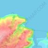
Topografische Karte Rozadas

Klicken Sie auf die Karte, um die Höhe anzuzeigen.

Über diese Karte

Name: Topografische Karte Rozadas, Höhe, Relief.

Ort: Rozadas, Villaviciosa, Asturias, España (43.42260 -5.55857 43.47230 -5.49316)

Durchschnittliche Höhe: 323 m

Minimale Höhe: 55 m

Maximale Höhe: 638 m

Andere topografische Karten

Klicken Sie auf eine Karte, um ihre Topografie, ihre Höhe und ihr Relief anzuzeigen.
Quintes

España > Asturias > Villaviciosa > Cimadevilla

Durchschnittliche Höhe: 107 m

Casquita

España > Asturias > Villaviciosa > Casquita

Durchschnittliche Höhe: 80 m

Barzana

España > Asturias > Villaviciosa > Barzana

Durchschnittliche Höhe: 94 m

Río España

España > Asturias > Villaviciosa > Santa Ana

Durchschnittliche Höhe: 78 m

La Viesca

España > Asturias > Villaviciosa

Durchschnittliche Höhe: 202 m

San Feliz

España > Asturias > Villaviciosa

Durchschnittliche Höhe: 228 m

El Monasterio

España > Asturias > Villaviciosa

Durchschnittliche Höhe: 77 m

Punta de la Mesnada

España > Asturias > Villaviciosa

Durchschnittliche Höhe: 44 m

La Rivera

España > Asturias > Villaviciosa

Durchschnittliche Höhe: 213 m

Peón

España > Asturias > Villaviciosa

Durchschnittliche Höhe: 224 m

Fabares

España > Asturias > Villaviciosa

Durchschnittliche Höhe: 380 m

Brañaverniz

España > Asturias > Villaviciosa

Durchschnittliche Höhe: 209 m

La Infiesta

España > Asturias > Villaviciosa

Durchschnittliche Höhe: 268 m

Tazones

España > Asturias > Villaviciosa

Durchschnittliche Höhe: 51 m

Rüste dich für dein nächstes Abenteuer:

🛠️Reparatur‑Sets für Outdoor - Sets für Ausrüstungsreparaturen unterwegs
💼Reise‑Organizer & Packsäcke - Organisation für Rucksack und Gepäck
🧤Seiden-Unterziehhandschuhe - Zusätzliche Wärme bei minimalem Volumen
🧥Fleecejacken - Wärmende Zwischenschicht für kühle Morgenstunden
🪓Camping‑Werkzeuge - Unentbehrliche Werkzeuge für Outdoor‑Camps

Als Amazon-Partner verdient diese Seite an qualifizierten Käufen, ohne dass Ihnen zusätzliche Kosten entstehen.