Geolokalisieren

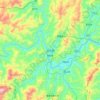
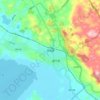
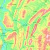
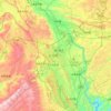
Topografische Karte Liupanshui

Klicken Sie auf die Karte, um die Höhe anzuzeigen.

Liupanshui

Liupanshui belongs to the subtropical monsoon humid climate zone. Affected by the low latitude and high altitude, it has a pleasant climate with warm winters and cool summers. The annual average temperature is 15 °C, the average temperature in January is 3 to 6.3 °C, and the average temperature in July is 19.8 °C to 22 °C.

Wikipedia (CC-BY-SA 3.0)

Über diese Karte

Name: Topografische Karte Liupanshui, Höhe, Relief.

Ort: Liupanshui, Guizhou, China (25.33156 104.30701 26.92341 105.71899)

Durchschnittliche Höhe: 1’753 m

Minimale Höhe: 597 m

Maximale Höhe: 2’838 m

Andere topografische Karten

Klicken Sie auf eine Karte, um ihre Topografie, ihre Höhe und ihr Relief anzuzeigen.

Jiamian

China > Guizhou > Congjiang

Durchschnittliche Höhe: 940 m

Congjiang

China > Guizhou > Congjiang

Durchschnittliche Höhe: 526 m

Pugu

China > Guizhou > Liupanshui

Durchschnittliche Höhe: 1’927 m

Shitouzhai

China > Guizhou > Guiyang

Durchschnittliche Höhe: 1’120 m

Bidai

China > Guizhou > Liupanshui

Durchschnittliche Höhe: 2’069 m

Mayi

China > Guizhou > Liupanshui

Durchschnittliche Höhe: 1’693 m

Fanjing Mountain

China > Guizhou > Yinjiang Tujia and Miao Autonomous County

The Fanjingshan (Chinese: 梵净山; pinyin: Fànjìngshān) or Mount Fanjing, located in Tongren, Guizhou province, is the highest peak of the Wuling Mountains in southeastern China, at an elevation of 2,570 m (8,430 ft). The Fanjingshan National Nature Reserve was established in 1978 and designated a UNESCO…

Durchschnittliche Höhe: 2’054 m
Zhaoxing Dong Village

China > Guizhou > Liping

Durchschnittliche Höhe: 547 m

Zhenyuan

China > Guizhou > Zhenyuan

Durchschnittliche Höhe: 818 m

Fanjingshan

China > Guizhou

The Fanjingshan (Chinese: 梵净山; pinyin: Fànjìngshān) or Mount Fanjing, located in Tongren, Guizhou province, is the highest peak of the Wuling Mountains in southwestern China, at an elevation of 2,570 m (8,430 ft). The Fanjingshan National Nature Reserve was established in 1978 and designated a UNESCO…

Durchschnittliche Höhe: 1’958 m

Jinzhong

China > Guizhou > Weining Yi Hui and Miao Autonomous County

Durchschnittliche Höhe: 2’089 m

Bijie

China > Guizhou > Bijie

Bijie borders Zunyi to the east, Anshun and Liupanshui to the south, Zhaotong and Qujing (Yunnan) to the west, and Luzhou (Sichuan) to the north. It spans latitude 26°21′−27°46′ N and longitude 105°36′−106°43′ E, and is marked heavily by the presence of the Wumeng Mountains (乌蒙山) as well…

Durchschnittliche Höhe: 1’651 m
东关村

China > Guizhou > Anshun

Durchschnittliche Höhe: 1’387 m

Caohai

China > Guizhou > Weining Yi Hui and Miao Autonomous County

Durchschnittliche Höhe: 2’260 m

Zhaoxing

China > Guizhou > Liping

Durchschnittliche Höhe: 615 m

Huajiang

China > Guizhou > Anshun

Durchschnittliche Höhe: 1’233 m

Liping

China > Guizhou > Liping

Durchschnittliche Höhe: 657 m

Zhijie

China > Guizhou > Hezhang

Durchschnittliche Höhe: 2’057 m

Pugu

China > Guizhou > Liupanshui

Durchschnittliche Höhe: 1’927 m

Hangdong

China > Guizhou > Anlong > Sayu

Durchschnittliche Höhe: 1’374 m

Jianhe

China > Guizhou > Jianhe

Durchschnittliche Höhe: 819 m

Guandong

China > Guizhou > Congjiang

Durchschnittliche Höhe: 426 m

Lion Hill

China > Guizhou > Anshun

Durchschnittliche Höhe: 1’404 m

Bulang

China > Guizhou > Anshun

Durchschnittliche Höhe: 1’334 m

Fagu

China > Guizhou > Hezhang

Durchschnittliche Höhe: 2’199 m

Yungui

China > Guizhou > Weining Yi Hui and Miao Autonomous County

Durchschnittliche Höhe: 1’895 m

Tianxingqiao

China > Guizhou > Qixingguan

Durchschnittliche Höhe: 1’598 m

Layang

China > Guizhou > Wangmo

Durchschnittliche Höhe: 714 m

Tongmu

China > Guizhou > Guiyang

Durchschnittliche Höhe: 1’114 m

Lamai

China > Guizhou > Pingtang

Durchschnittliche Höhe: 852 m

Layan

China > Guizhou > Cengong

Durchschnittliche Höhe: 593 m

Banqiao

China > Guizhou > Huichuan

Durchschnittliche Höhe: 1’109 m

Luohua

China > Guizhou > Ceheng

Durchschnittliche Höhe: 837 m

Zhongshui

China > Guizhou > Weining Yi Hui and Miao Autonomous County

Durchschnittliche Höhe: 1’930 m

Sandu

China > Guizhou > Huishui

Durchschnittliche Höhe: 1’023 m

Qianxinan

China > Guizhou > Xingyi

Durchschnittliche Höhe: 1’406 m

Rüste dich für dein nächstes Abenteuer:

🧗‍♂️Grundausrüstung Klettern - Klettergurte, Karabiner und Zubehör für Einsteiger
🎒Wander‑Rucksäcke - Geräumige und leichte Rucksäcke für Tages‑ und Mehrtagestouren
🛠️Reparatur‑Sets für Outdoor - Sets für Ausrüstungsreparaturen unterwegs
📱Smartphone-Halterungen - Schneller Zugriff auf Wander-Apps und Karten
📦Notrationen & Trekkingnahrung - Leichte, energiereiche Lebensmittel für Touren

Als Amazon-Partner verdient diese Seite an qualifizierten Käufen, ohne dass Ihnen zusätzliche Kosten entstehen.