
Topografische Karte Sayre
Klicken Sie auf die Karte, um die Höhe anzuzeigen.
Sayre
Sayre is located at 35°17′56″N 99°38′12″W / 35.29889°N 99.63667°W / 35.29889; -99.63667 (35.298940, -99.636556). It is located on the North Fork of the Red River, at an elevation of 1,800 feet (550 m) and 128 miles (206 km) west of Oklahoma City. The area is dominated by low rolling red clay hills.
Über diese Karte
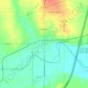
Name: Topografische Karte Sayre, Höhe, Relief.
Ort: Sayre, Beckham County, Oklahoma, 73662, United States (35.27116 -99.66010 35.31116 -99.62010)
Durchschnittliche Höhe: 560 m
Minimale Höhe: 541 m
Maximale Höhe: 588 m