
Topografische Karte Kedma
Interaktive Karte
Klicken Sie auf die Karte, um die Höhe anzuzeigen.
Über diese Karte
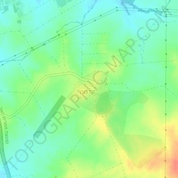
Name: Topografische Karte Kedma, Höhe, Relief.
Durchschnittliche Höhe: 90 m
Minimale Höhe: 72 m
Maximale Höhe: 119 m
Andere topografische Karten
Klicken Sie auf eine Karte, um ihre Topografie, ihre Höhe und ihr Relief anzuzeigen.
Tel Tsafit
Israel > South District > Yoav Regional Council
Tel Tsafit, Yoav Regional Council, Ashkelon Subdistrict, South District, Israel
Durchschnittliche Höhe: 147 m
Beit Nir
Israel > South District > Yoav Regional Council
Beit Nir, Yoav Regional Council, Ashkelon Subdistrict, South District, Israel
Durchschnittliche Höhe: 228 m