
Topografische Karte Ghatsila
Klicken Sie auf die Karte, um die Höhe anzuzeigen.
Ghatsila
Ghatshila is located at 22°36′N 86°29′E / 22.60°N 86.48°E / 22.60; 86.48. It has an average elevation of 103 m (338 ft).
Über diese Karte
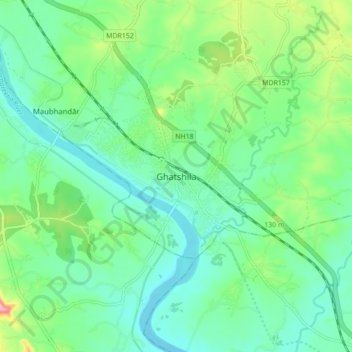
Name: Topografische Karte Ghatsila, Höhe, Relief.
Ort: Ghatsila, Ghatshila, East Singhbhum, Jharkhand, 832303, India (22.54531 86.43682 22.62531 86.51682)
Durchschnittliche Höhe: 107 m
Minimale Höhe: 71 m
Maximale Höhe: 205 m