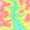
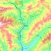
Topografische Karte Maqu County
Klicken Sie auf die Karte, um die Höhe anzuzeigen.
Maqu County
Maqu County (simplified Chinese: 玛曲县; traditional Chinese: 瑪曲縣; pinyin: Mǎqū Xiàn; Tibetan: རྨ་ཆུ་རྫོང་།, Wylie: Rma chu rdzong, ZYPY: Maqu Zong) is a county of the Gannan Tibetan Autonomous Prefecture in the south of Gansu province of the People's Republic of China, bordering the provinces of Sichuan to the east and southeast, and Qinghai to the southwest, west and northwest. Its postal code is 747300, and in 1999 its population was 36,213 people. The area of Maqu County is 10,191 km2 with an average altitude of 3,700 meters. Maqu County receives high rainfall and is located at the northern edge of the Zoigê Marshes on the Yellow River where conditions are optimal for alpine meadow vegetation.
Über diese Karte

Name: Topografische Karte Maqu County, Höhe, Relief.
Ort: Maqu County, Gannan, Gansu, China (33.10520 100.76286 34.38453 102.48214)
Durchschnittliche Höhe: 3’812 m
Minimale Höhe: 3’305 m
Maximale Höhe: 5’295 m
Andere topografische Karten
Klicken Sie auf eine Karte, um ihre Topografie, ihre Höhe und ihr Relief anzuzeigen.


Zhangye Danxia National Geological Park
China > Gansu > Linze County > Nantai
Durchschnittliche Höhe: 1’759 m

龚岔牧饲点
China > Gansu > Subei Mongol Autonomous County > Shibaocheng > 鹰嘴山村
Durchschnittliche Höhe: 2’181 m

Gannan
China > Gansu > Hezuo City > Tongqin
Gannan, as illustrated by this chart for Xiahe, has an alpine subarctic climate (Köppen Dwc) that grades into an alpine climate (ETH) at the highest elevations. The climate is characterised by mild, rainy summers and frigid, but dry and sunny, winters.
Durchschnittliche Höhe: 3’075 m
Mount Qilian
China > Gansu > Sunan Yugur Autonomous County > Qifeng Tibetan Ethnic Township
Durchschnittliche Höhe: 5’071 m


Junma Sichang Qilian
China > Gansu > Shandan County > Shandan horse breeding area
Durchschnittliche Höhe: 2’558 m