

Topografische Karte Cronulla Point
Klicken Sie auf die Karte, um die Höhe anzuzeigen.
Über diese Karte

Name: Topografische Karte Cronulla Point, Höhe, Relief.
Durchschnittliche Höhe: 7 m
Minimale Höhe: -1 m
Maximale Höhe: 39 m
Andere topografische Karten
Klicken Sie auf eine Karte, um ihre Topografie, ihre Höhe und ihr Relief anzuzeigen.
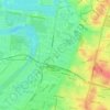
Penrith
Australia > New South Wales > Sydney > Penrith
Penrith is a city in New South Wales, Australia, located in Greater Western Sydney, 55 kilometres (31 mi) west of the Sydney central business district on the banks of the Nepean River, on the outskirts of the Cumberland Plain. Its elevation is 32 metres (105 ft).
Durchschnittliche Höhe: 34 m
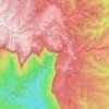
Wentworth Falls
Australia > New South Wales > Sydney
Wentworth Falls (postcode: 2782) is a town in the Blue Mountains region of New South Wales, situated approximately 100 kilometres (62 mi) west of the Sydney central business district, and about 8 kilometres (5.0 mi) east of Katoomba, Australia on the Great Western Highway, with a Wentworth Falls railway…
Durchschnittliche Höhe: 708 m
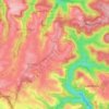
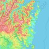



Terrey Hills
Australia > New South Wales > Sydney
Owing to its elevation and close proximity to the ocean, as well as its extensive tree canopy cover, the weather station at Terrey Hills records the mildest temperatures of any weather station in the Greater Sydney region. Under Köppen's scheme, the suburb has a borderline humid subtropical (Cfa) and oceanic…
Durchschnittliche Höhe: 146 m

Thornleigh
Australia > New South Wales > Sydney
Thornleigh is bounded to the north by Waitara Creek and south by the Lane Cove National Park. Thornleigh borders the suburbs of Normanhurst, Hornsby, Wahroonga, Westleigh and Pennant Hills. Thornleigh offers great district views, and the topography varies greatly with many established areas built around…
Durchschnittliche Höhe: 159 m


Bents Basin State Conservation Area
Australia > New South Wales > Sydney
The park is popular for swimming, kayaking, bushwalking, camping (with 100 tent sites), barbecuing, picnicking and fishing. The park also features walking trails within a bushland and an education centre with a commercial kitchen. Caley's Lookout Track, a walking track within the bushland, leads to Little…
Durchschnittliche Höhe: 82 m












Lucas Heights
Australia > New South Wales > Sydney
Due to its elevation, Lucas Heights is one of the few places in Sydney that has a borderline Oceanic (Cfb) and a Humid subtropical climate (Cfa).
Durchschnittliche Höhe: 115 m



















Nielsen Park
Australia > New South Wales > Sydney
As is common in all coastal and estuarine areas of the Sydney Region, the Park contains many rock outcrops, particularly along the foreshore headlands. These are given some added interest by the remnants of the effect of a basalt dyke that runs from Mount Trefle to Bottle and Glass Point resulting in the…
Durchschnittliche Höhe: 14 m

