
Topografische Karte Malad
Interaktive Karte
Klicken Sie auf die Karte, um die Höhe anzuzeigen.
Über diese Karte
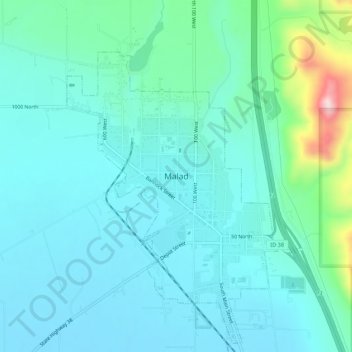
Name: Topografische Karte Malad, Höhe, Relief.
Ort: Malad, Malad City, Oneida County, Idaho, United States (42.15159 -112.29080 42.23159 -112.21080)
Durchschnittliche Höhe: 1’467 m
Minimale Höhe: 1’348 m
Maximale Höhe: 2’091 m
According to the United States Census Bureau, the city has a total area of 1.66 square miles (4.30 km2), all of it land. It lies on the eastern edge of Malad Valley at 4,540 feet (1384 m) in elevation.
Andere topografische Karten
Klicken Sie auf eine Karte, um ihre Topografie, ihre Höhe und ihr Relief anzuzeigen.
Cedarhill
United States > Idaho > Oneida County
Cedarhill, Oneida County, Idaho, United States
Durchschnittliche Höhe: 1’651 m
Malad City
United States > Idaho > Oneida County
Malad City, Oneida County, Idaho, United States
Durchschnittliche Höhe: 1’406 m