
Topografische Karte West Jordan
Interaktive Karte
Klicken Sie auf die Karte, um die Höhe anzuzeigen.
Über diese Karte
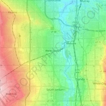
Name: Topografische Karte West Jordan, Höhe, Relief.
Ort: West Jordan, Salt Lake County, Utah, United States (40.56594 -112.08259 40.64014 -111.91174)
Durchschnittliche Höhe: 1’372 m
Minimale Höhe: 1’296 m
Maximale Höhe: 1’507 m
West Jordan is a city in Salt Lake County, Utah, United States. It is a rapidly growing suburb of Salt Lake City and has a mixed economy. According to the 2010 Census, the city had a population of 103,712, placing it as the fourth most populous in the state. The city occupies the southwest end of the Salt Lake Valley at an elevation of 4,330 feet (1,320 m). Named after the nearby Jordan River, the limits of the city begin on the river's western bank and end in the eastern foothills of the Oquirrh Mountains, where Kennecott Copper Mine, the world's largest man-made excavation is located.