
Topografische Karte River Hall
Klicken Sie auf die Karte, um die Höhe anzuzeigen.
Über diese Karte
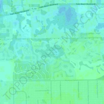
Name: Topografische Karte River Hall, Höhe, Relief.
Ort: River Hall, Lee County, Florida, United States (26.67679 -81.71513 26.71679 -81.67513)
Durchschnittliche Höhe: 7 m
Minimale Höhe: 3 m
Maximale Höhe: 10 m
Andere topografische Karten
Klicken Sie auf eine Karte, um ihre Topografie, ihre Höhe und ihr Relief anzuzeigen.
Fort Myers
United States > Florida > Lee County
Fort Myers, located in Lee County, Florida, features a predominantly flat topography characterized by low elevations, averaging around 10 to 16 feet (approximately 3 to 5 meters) above sea level. The area is primarily composed of coastal plains, which contribute to its lush, subtropical vegetation and…
Durchschnittliche Höhe: 5 m
Cape Coral
United States > Florida > Lee County
Cape Coral is characterized by its predominantly flat and low-lying terrain, with an average elevation of around 13 feet (4 meters) above sea level. The area's topography features a network of canals, with over 400 miles of navigable waterways, making it one of the most waterway-dense cities globally. The…
Durchschnittliche Höhe: 4 m
Fort Myers Shores
United States > Florida > Lee County > Fort Myers Shores
Durchschnittliche Höhe: 5 m
Fort Myers Shores
United States > Florida > Lee County > Fort Myers Shores
Durchschnittliche Höhe: 5 m
Three Oaks
United States > Florida > Lee County > San Carlos Park > Three Oaks
Durchschnittliche Höhe: 8 m