Topografische Karte Melfi
Klicken Sie auf die Karte, um die Höhe anzuzeigen.
Melfi
The Castle, dominates the whole town. It was probably constructed ex novo by the Normans (11th century), as no trace of pre-existing Byzantine or Lombard edifices has been found. Originally, it was probably a simple rectangle with square towers, with further towers defending the main gate. One of the main internal buildings was later (16th-18th centuries) turned into a baronial palace by enclosing the walls between the towers within new walls. Under the Angevine rule a new section was added on the slope descending to the Melfia stream, with several constructions rising at different altitudes. The Castle was chosen by King Charles II's wife, Mary of Hungary, as her residence. The Aragon kings gave it to the Caracciolo family, who rebuilt the side facing the city and dug a moat. Later it was a possession of the powerful House of Doria.
Über diese Karte
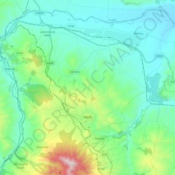
Name: Topografische Karte Melfi, Höhe, Relief.
Ort: Melfi, Potenza, Basilicata, 85025, Italy (40.94867 15.54287 41.10055 15.76704)
Durchschnittliche Höhe: 377 m
Minimale Höhe: 138 m
Maximale Höhe: 1’299 m
Andere topografische Karten
Klicken Sie auf eine Karte, um ihre Topografie, ihre Höhe und ihr Relief anzuzeigen.