Geolokalisieren

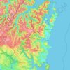
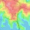
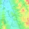
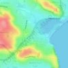
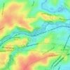
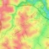
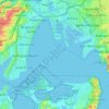
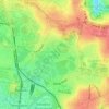
Topografische Karte Rozelle Bay

Klicken Sie auf die Karte, um die Höhe anzuzeigen.

Über diese Karte

Name: Topografische Karte Rozelle Bay, Höhe, Relief.

Ort: Rozelle Bay, Sydney, New South Wales, 2039, Australia (-33.87092 151.17847 -33.87082 151.17857)

Durchschnittliche Höhe: 17 m

Minimale Höhe: -10 m

Maximale Höhe: 46 m

Andere topografische Karten

Klicken Sie auf eine Karte, um ihre Topografie, ihre Höhe und ihr Relief anzuzeigen.
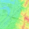
Penrith

Australia > New South Wales > Sydney > Penrith

Penrith is a city in New South Wales, Australia, located in Greater Western Sydney, 55 kilometres (31 mi) west of the Sydney central business district on the banks of the Nepean River, on the outskirts of the Cumberland Plain. Its elevation is 32 metres (105 ft).

Durchschnittliche Höhe: 34 m

Milperra

Australia > New South Wales > Sydney

Durchschnittliche Höhe: 8 m

Northern Beaches

Australia > New South Wales > Sydney

Durchschnittliche Höhe: 67 m

Lower North Shore

Australia > New South Wales > Sydney

Durchschnittliche Höhe: 45 m

Edensor Park

Australia > New South Wales > Sydney

Durchschnittliche Höhe: 57 m

Camellia

Australia > New South Wales > Sydney

Durchschnittliche Höhe: 11 m

Ingleside

Australia > New South Wales > Sydney

Durchschnittliche Höhe: 89 m

Darlinghurst

Australia > New South Wales > Sydney

Durchschnittliche Höhe: 38 m

Annandale

Australia > New South Wales > Sydney

Durchschnittliche Höhe: 24 m

Berowra

Australia > New South Wales > Sydney

Berowra is located 44 kilometres north of the Sydney CBD and lies at an altitude of 215 metres. Surrounded by bushland, it borders the national parks of both the Berowra Valley and Ku-ring-gai Chase.

Durchschnittliche Höhe: 144 m
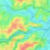
Earlwood

Australia > New South Wales > Sydney

Durchschnittliche Höhe: 23 m

North Sydney

Australia > New South Wales > Sydney

Durchschnittliche Höhe: 50 m

Sydney

Australia > New South Wales > Sydney

Durchschnittliche Höhe: 23 m

Box Hill

Australia > New South Wales > Sydney

Durchschnittliche Höhe: 45 m

Sydney Water Supply Canal

Australia > New South Wales > Sydney

Durchschnittliche Höhe: 98 m

Scheyville

Australia > New South Wales > Sydney

Durchschnittliche Höhe: 38 m

Mosman

Australia > New South Wales > Sydney

Durchschnittliche Höhe: 29 m

Schofields

Australia > New South Wales > Sydney

Durchschnittliche Höhe: 32 m

Leichhardt

Australia > New South Wales > Sydney

Durchschnittliche Höhe: 22 m

Bankstown

Australia > New South Wales > Sydney

Durchschnittliche Höhe: 34 m

Sutherland Shire Council

Australia > New South Wales > Sydney

Durchschnittliche Höhe: 79 m

Marrickville

Australia > New South Wales > Sydney

Durchschnittliche Höhe: 17 m

Blacktown

Australia > New South Wales > Sydney

Durchschnittliche Höhe: 57 m

Clovelly

Australia > New South Wales > Sydney

Durchschnittliche Höhe: 32 m

Killarney Heights

Australia > New South Wales > Sydney

Durchschnittliche Höhe: 72 m

Randwick

Australia > New South Wales > Sydney

Durchschnittliche Höhe: 44 m

St Ives

Australia > New South Wales > Sydney

Durchschnittliche Höhe: 125 m

Mount Druitt

Australia > New South Wales > Sydney

Durchschnittliche Höhe: 52 m

Turramurra

Australia > New South Wales > Sydney

Durchschnittliche Höhe: 143 m

Dee Why

Australia > New South Wales > Sydney

Durchschnittliche Höhe: 31 m

Rose Bay

Australia > New South Wales > Sydney

Durchschnittliche Höhe: 31 m

Northern Beaches Council

Australia > New South Wales > Sydney

Durchschnittliche Höhe: 67 m

Bondi Beach

Australia > New South Wales > Sydney

Durchschnittliche Höhe: 31 m

Mount Annan Botanic Garden

Australia > New South Wales > Sydney

Durchschnittliche Höhe: 115 m

Hills District

Australia > New South Wales > Sydney

Durchschnittliche Höhe: 91 m

Eastern Suburbs

Australia > New South Wales > Sydney

Durchschnittliche Höhe: 12 m

Woronora

Australia > New South Wales > Sydney

Woronora Plateau, is a geographical region adjacent to the Sydney Plain. Slightly higher in altitude, it is capped with Hawkesbury Sandstone. The Woronora River flows through the deeply dissected plateau to the Georges River from near the sources of the Port Hacking, within the Sutherland Shire.

Durchschnittliche Höhe: 65 m

Darling Point

Australia > New South Wales > Sydney

Durchschnittliche Höhe: 23 m

Wolli Creek

Australia > New South Wales > Sydney

Durchschnittliche Höhe: 27 m

Epping

Australia > New South Wales > Sydney

Durchschnittliche Höhe: 96 m

Wentworth Falls

Australia > New South Wales > Sydney

Wentworth Falls (postcode: 2782) is a town in the Blue Mountains region of New South Wales, situated approximately 100 kilometres (62 mi) west of the Sydney central business district, and about 8 kilometres (5.0 mi) east of Katoomba, Australia on the Great Western Highway, with a Wentworth Falls railway…

Durchschnittliche Höhe: 708 m
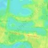
Scotland Island

Australia > New South Wales > Sydney

Durchschnittliche Höhe: 17 m

Carlingford

Australia > New South Wales > Sydney

Durchschnittliche Höhe: 98 m

Marsfield

Australia > New South Wales > Sydney

Durchschnittliche Höhe: 72 m

Baulkham Hills

Australia > New South Wales > Sydney

Durchschnittliche Höhe: 93 m

Eastwood

Australia > New South Wales > Sydney

Durchschnittliche Höhe: 80 m

North Ryde

Australia > New South Wales > Sydney

Durchschnittliche Höhe: 52 m

Botany Bay

Australia > New South Wales > Sydney

Durchschnittliche Höhe: 8 m

Kurnell

Australia > New South Wales > Sydney

Durchschnittliche Höhe: 4 m

Terrey Hills

Australia > New South Wales > Sydney

Owing to its elevation and close proximity to the ocean, as well as its extensive tree canopy cover, the weather station at Terrey Hills records the mildest temperatures of any weather station in the Greater Sydney region. Under Köppen's scheme, the suburb has a borderline humid subtropical (Cfa) and oceanic…

Durchschnittliche Höhe: 146 m
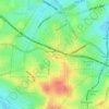
Ashfield

Australia > New South Wales > Sydney

Durchschnittliche Höhe: 26 m

Roseville

Australia > New South Wales > Sydney

Durchschnittliche Höhe: 84 m

Camperdown

Australia > New South Wales > Sydney

Durchschnittliche Höhe: 26 m

Badgerys Creek

Australia > New South Wales > Sydney

Durchschnittliche Höhe: 88 m

Leppington

Australia > New South Wales > Sydney

Durchschnittliche Höhe: 89 m

Engadine

Australia > New South Wales > Sydney

Durchschnittliche Höhe: 121 m

Bellevue Hill

Australia > New South Wales > Sydney

Durchschnittliche Höhe: 36 m

Balgowlah Heights

Australia > New South Wales > Sydney

Durchschnittliche Höhe: 25 m

Centennial Park

Australia > New South Wales > Sydney

Durchschnittliche Höhe: 51 m

Zetland

Australia > New South Wales > Sydney

Durchschnittliche Höhe: 26 m

Hornsby

Australia > New South Wales > Sydney

Durchschnittliche Höhe: 160 m

Cooks River

Australia > New South Wales > Sydney

Durchschnittliche Höhe: 29 m

Thornleigh

Australia > New South Wales > Sydney

Thornleigh is bounded to the north by Waitara Creek and south by the Lane Cove National Park. Thornleigh borders the suburbs of Normanhurst, Hornsby, Wahroonga, Westleigh and Pennant Hills. Thornleigh offers great district views, and the topography varies greatly with many established areas built around…

Durchschnittliche Höhe: 159 m

Bilgola Beach

Australia > New South Wales > Sydney

Durchschnittliche Höhe: 35 m

Lane Cove National Park

Australia > New South Wales > Sydney

The park includes areas of land which are part of Ku-ring-gai, Ryde, and Hornsby local government areas with small areas of the park in Willoughby, Lane Cove and Hunter's Hill local government areas on the banks of the lower reaches of the river. The park is surrounded on all sides by developed suburban areas…

Durchschnittliche Höhe: 81 m
Ryde

Australia > New South Wales > Sydney

Durchschnittliche Höhe: 52 m

Sydney Water Supply Canal

Australia > New South Wales > Sydney

Durchschnittliche Höhe: 134 m

Warners Park

Australia > New South Wales > Sydney

Durchschnittliche Höhe: 62 m

Warragamba Dam

Australia > New South Wales > Sydney

Durchschnittliche Höhe: 156 m

Hyde Park South

Australia > New South Wales > Sydney

Durchschnittliche Höhe: 31 m

Pyes Creek

Australia > New South Wales > Sydney

Durchschnittliche Höhe: 168 m

Innisfall Park

Australia > New South Wales > Sydney

Durchschnittliche Höhe: 31 m

Bridge Road Reserve

Australia > New South Wales > Sydney

Durchschnittliche Höhe: 32 m

Bents Basin State Conservation Area

Australia > New South Wales > Sydney

The park is popular for swimming, kayaking, bushwalking, camping (with 100 tent sites), barbecuing, picnicking and fishing. The park also features walking trails within a bushland and an education centre with a commercial kitchen. Caley's Lookout Track, a walking track within the bushland, leads to Little…

Durchschnittliche Höhe: 82 m

Asquith Park

Australia > New South Wales > Sydney

Durchschnittliche Höhe: 172 m

Clontarf

Australia > New South Wales > Sydney

Durchschnittliche Höhe: 35 m

Gibberagong Waterhole

Australia > New South Wales > Sydney

Durchschnittliche Höhe: 135 m

Forrester Reserve

Australia > New South Wales > Sydney

Durchschnittliche Höhe: 34 m

Parramatta River

Australia > New South Wales > Sydney

Durchschnittliche Höhe: 25 m

Claydon Reserve

Australia > New South Wales > Sydney

Durchschnittliche Höhe: 10 m

Oakhurst

Australia > New South Wales > Sydney

Durchschnittliche Höhe: 49 m

Cattai Creek

Australia > New South Wales > Sydney

Durchschnittliche Höhe: 39 m

Redfern Park

Australia > New South Wales > Sydney

Durchschnittliche Höhe: 31 m

Newport

Australia > New South Wales > Sydney

Durchschnittliche Höhe: 27 m

Darvall Park

Australia > New South Wales > Sydney

Durchschnittliche Höhe: 61 m

Enmore

Australia > New South Wales > Sydney

Durchschnittliche Höhe: 23 m

Clontarf Reserve

Australia > New South Wales > Sydney

Durchschnittliche Höhe: 37 m

Northumberland Reserve

Australia > New South Wales > Sydney

Durchschnittliche Höhe: 16 m

Bayview Park

Australia > New South Wales > Sydney

Durchschnittliche Höhe: 10 m

Cronulla Sand Dunes

Australia > New South Wales > Sydney

Durchschnittliche Höhe: 5 m

Koala Park

Australia > New South Wales > Sydney

Durchschnittliche Höhe: 149 m

Nielsen Park

Australia > New South Wales > Sydney

As is common in all coastal and estuarine areas of the Sydney Region, the Park contains many rock outcrops, particularly along the foreshore headlands. These are given some added interest by the remnants of the effect of a basalt dyke that runs from Mount Trefle to Bottle and Glass Point resulting in the…

Durchschnittliche Höhe: 14 m

UTS Alumni Green

Australia > New South Wales > Sydney

Durchschnittliche Höhe: 29 m

Cremorne Point

Australia > New South Wales > Sydney

Durchschnittliche Höhe: 29 m

Lucas Heights

Australia > New South Wales > Sydney

Due to its elevation, Lucas Heights is one of the few places in Sydney that has a borderline Oceanic (Cfb) and a Humid subtropical climate (Cfa).

Durchschnittliche Höhe: 115 m

Inner West Council

Australia > New South Wales > Sydney

Durchschnittliche Höhe: 19 m

Sylvania

Australia > New South Wales > Sydney

Durchschnittliche Höhe: 19 m

Woodford

Australia > New South Wales > Sydney

Woodford is a village in the Blue Mountains in New South Wales, Australia, about 90 kilometres west of Sydney. Its elevation is 609 metres (1,998 ft) above sea level. It is situated on the Great Western Highway and has a railway station (opened in 1868 as Buss's Platform) on the Main Western railway line…

Durchschnittliche Höhe: 544 m
Hurstville

Australia > New South Wales > Sydney

Durchschnittliche Höhe: 50 m

Rüste dich für dein nächstes Abenteuer:

🧼Biologische Outdoor-Seife - Umweltfreundliche Hygiene in der Natur
🕯️Sturmlaternen - Atmosphärisches Licht für die Alphütte
🥾Wanderschuhe Herren - Robuste und bequeme Wanderschuhe für alle Geländearten
🧥Hardshelljacken - Extremer Wetterschutz für alpine Touren in der Schweiz
🍼Edelstahl-Trinkflaschen - Nachhaltig und robust für jede Outdoor-Aktivität

Als Amazon-Partner verdient diese Seite an qualifizierten Käufen, ohne dass Ihnen zusätzliche Kosten entstehen.