
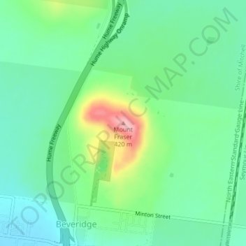
Topografische Karte Mount Fraser
Interaktive Karte
Klicken Sie auf die Karte, um die Höhe anzuzeigen.
Über diese Karte
Name: Topografische Karte Mount Fraser, Höhe, Relief.
Durchschnittliche Höhe: 309 m
Minimale Höhe: 262 m
Maximale Höhe: 423 m
Andere topografische Karten
Klicken Sie auf eine Karte, um ihre Topografie, ihre Höhe und ihr Relief anzuzeigen.
Truganina
Australien > Victoria > Melbourne
Truganina, Melbourne, City of Wyndham, Victoria, 3029, Australien
Durchschnittliche Höhe: 57 m
Poowong
Australien > Victoria > Poowong
Poowong, Shire of South Gippsland, Gippsland, Victoria, Australien
Durchschnittliche Höhe: 161 m
Bacchus Marsh
Australien > Victoria > Bacchus Marsh
Bacchus Marsh, Shire of Moorabool, Grampians, Victoria, 3340, Australien
Durchschnittliche Höhe: 132 m
Poowong
Australien > Victoria > Poowong
Poowong, Shire of South Gippsland, Gippsland, Victoria, Australien
Durchschnittliche Höhe: 156 m
Avalon
Australien > Victoria > Geelong
Avalon, Geelong, City of Greater Geelong, Barwon South West, Victoria, 3212, Australien
Durchschnittliche Höhe: 9 m
Hattah - Kulkyne NP
Australien > Victoria > Colignan
Hattah - Kulkyne NP, Reed Road, Hattah, Colignan, Rural City of Mildura, Loddon Mallee, Victoria, Australien
Durchschnittliche Höhe: 51 m
Lake Keilambete
Australien > Victoria > Noorat
Lake Keilambete, Sisters-Noorat Road, Noorat, Shire of Corangamite, Barwon South West, Victoria, 3264, Australien
Durchschnittliche Höhe: 126 m
Fitzroy River
Fitzroy River, Shire of Glenelg, Barwon South West, Victoria, 3285, Australien
Durchschnittliche Höhe: 44 m
Cardinia Reservoir
Cardinia Reservoir, Cardinia Reservoir Access Road, Emerald, Shire of Cardinia, Victoria, 3802, Australien
Durchschnittliche Höhe: 177 m
Greenvale Reservoir
Australien > Victoria > Craigieburn
Greenvale Reservoir, Greenvale Short Cut Road, Greenvale, Craigieburn, City of Hume, Victoria, 3064, Australien
Durchschnittliche Höhe: 176 m
Alpine NP
Alpine NP, Harrietville, Alpine Shire, Hume, Victoria, 3723, Australien
Durchschnittliche Höhe: 588 m
Snowy River
Snowy River, Shire of East Gippsland, Gippsland, Victoria, 3888, Australien
Durchschnittliche Höhe: 693 m
Wilsons Promontory NP
Wilsons Promontory NP, Vereker Outlook, Wilsons Promontory, Shire of South Gippsland, Gippsland, Victoria, Australien
Durchschnittliche Höhe: 32 m
Cobungra River
Cobungra River, Shire of East Gippsland, Gippsland, Victoria, Australien
Durchschnittliche Höhe: 1’215 m
Lake Colongulac
Australien > Victoria > Chocolyn
Lake Colongulac, Chocolyn Road, Camperdown, Chocolyn, Shire of Corangamite, Barwon South West, Victoria, 3260, Australien
Durchschnittliche Höhe: 140 m
Croajingolong NP
Croajingolong NP, Lake Barracotta Link Track, Genoa, Shire of East Gippsland, Gippsland, Victoria, Australien
Durchschnittliche Höhe: 50 m
Badger Creek
Australien > Victoria > Healesville
Badger Creek, Healesville, Shire of Yarra Ranges, Victoria, Australien
Durchschnittliche Höhe: 255 m