
Topografische Karte Gomoh
Klicken Sie auf die Karte, um die Höhe anzuzeigen.
Gomoh
Gomoh is located at 23°52′N 86°10′E / 23.87°N 86.17°E / 23.87; 86.17. It has an average elevation of 245 metres (803 feet). The town has an area of 8.96 km2. It is 37 km from the district administrative headquarters in Dhanbad.
Über diese Karte
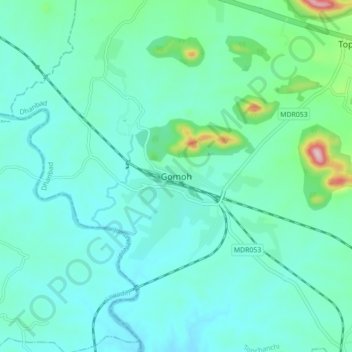
Name: Topografische Karte Gomoh, Höhe, Relief.
Ort: Gomoh, Topchanchi, Dhanbad, Jharkhand, 828401, India (23.83353 86.11159 23.91353 86.19159)
Durchschnittliche Höhe: 248 m
Minimale Höhe: 202 m
Maximale Höhe: 487 m