
Topografische Karte Broomfield
Interaktive Karte
Klicken Sie auf die Karte, um die Höhe anzuzeigen.
Über diese Karte
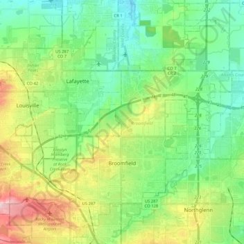
Name: Topografische Karte Broomfield, Höhe, Relief.
Ort: Broomfield, Colorado, United States (39.88920 -105.16726 40.04423 -104.96093)
Durchschnittliche Höhe: 1’609 m
Minimale Höhe: 1’532 m
Maximale Höhe: 1’777 m
The elevation in Broomfield ranges from 5,096 to 5,856 feet. At the 2020 United States Census, Broomfield had a total area of 21,471 acres (86.890 km2) including 371 acres (1.503 km2) of water. It is the smallest county by area in Colorado and the 5th smallest in the United States. Broomfield is the second most densely populated county in Colorado behind Denver.