

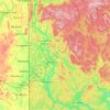
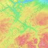
Topografische Karte Kennebecasis River
Klicken Sie auf die Karte, um die Höhe anzuzeigen.
Über diese Karte

Name: Topografische Karte Kennebecasis River, Höhe, Relief.
Durchschnittliche Höhe: 73 m
Minimale Höhe: -5 m
Maximale Höhe: 242 m
Andere topografische Karten
Klicken Sie auf eine Karte, um ihre Topografie, ihre Höhe und ihr Relief anzuzeigen.
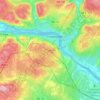
Fredericton
Canada > New Brunswick > Kingsclear Parish > Fredericton
At an altitude of about 17 m (56 ft) above sea level, Fredericton is nestled in the Pennsylvanian Basin. It differs markedly from the geologically older parts of the province. There are prominently two distinct areas in the region that are divided around the area of Wilsey Road, in the east end of the city. In…
Durchschnittliche Höhe: 72 m








City of Fredericton
At an altitude of about 17 m (56 ft) above sea level, Fredericton is nestled in the Pennsylvanian Basin. It differs markedly from the geologically older parts of the province. There are prominently two distinct areas in the region that are divided around the area of Wilsey Road, in the east end of the city. In…
Durchschnittliche Höhe: 71 m










Fredericton
Canada > New Brunswick > City of Fredericton
At an altitude of about 17 m (56 ft) above sea level, Fredericton is nestled in the Pennsylvanian Basin. It differs markedly from the geologically older parts of the province. There are prominently two distinct areas in the region that are divided around the area of Wilsey Road, in the east end of the city. In…
Durchschnittliche Höhe: 69 m

Northampton
Canada > New Brunswick > Carleton County > Town of Woodstock
Durchschnittliche Höhe: 140 m




Studholm Parish
Canada > New Brunswick > Butternut Valley Rural Community
Durchschnittliche Höhe: 101 m

Sainte-Marie-de-Kent
Canada > New Brunswick > Town of Champdoré > Sainte-Marie Parish
Durchschnittliche Höhe: 48 m

Little Branch
Canada > New Brunswick > Greater Miramichi Rural District > Glenelg Parish
Durchschnittliche Höhe: 10 m




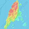
Grand Manan Island
Canada > New Brunswick > Village of Grand Manan > Grand Manan Parish
Durchschnittliche Höhe: 17 m